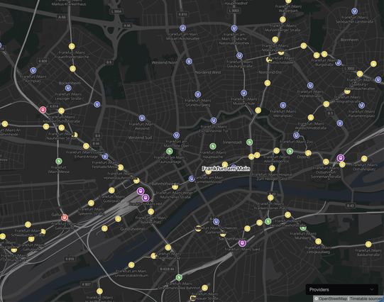
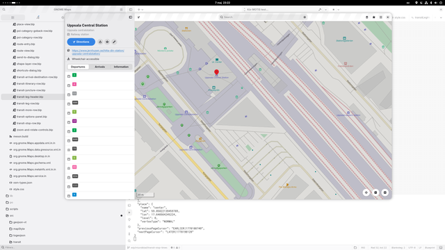
We're getting closer to the next #MOTIS release 😎
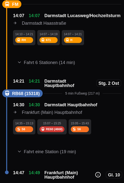
The next version will display stops on the map. The "highest" mode (high speed, long distance, local trains, metro, subway, trams, buses) will be used for the stop icon. Clicking on the stop will show its departure times.
I hope this feature will help with orientation when searching for the next bus stop :-)