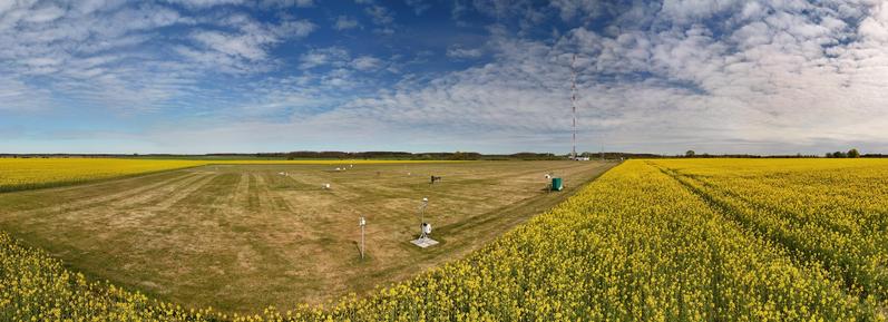
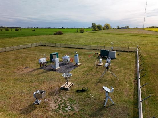
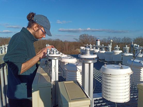
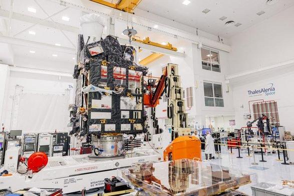
Tropical Cyclone #Gezani north of Mauritius is edging westward and predicted to strengthen ahead of an expected #Madagascar landfall on 10/11 Feb seen by #Meteosat-12 #CycloneGezani

Primeras imágenes del satélite Meteosat de Tercera Generación (MTG-S). Descubre cómo esta tecnología revolucionará la predicción meteorológica y el 'nowcasting' en Europa y España gracias a sus datos hiperespectrales.

#Meteosat #MTGS #Europa #Tutiempo

https://www.tutiempo.net/noticias/satelite-meteorologico-nueva-generacion-europa-primeras-imagenes.html

El satélite meteorológico de nueva generación de Europa envía sus primeras imágenes

Primeras imágenes del satélite Meteosat de Tercera Generación (MTG-S). Descubre cómo esta tecnología revolucionará la predicción meteorológica y el 'nowcasting' en Europa y España gracias a sus datos hiperespectrales.

TuTiempo.net
🛰️🌍 Les 2 premières images du satellite #Meteosat MTG-S1 lancé en juillet dernier, ont été publiées. Elles montrent des données de températures et d'humidité pour des prévisions météorologiques plus précises en Europe.
Plus de détails : https://reves-d-espace.com/le-satellite-mtg-sounder-1-revele-ses-premieres-images-une-revolution-pour-la-meteo-en-europe-et-en-afrique-du-nord/
📷 Eumetsat
"[ESA] has released the first images from the Meteosat Third Generation-Sounder (MTG-S) satellite"
"...further data from the mission set to improve weather-forecasting models and improve measurements of air quality over Europe"
https://physicsworld.com/a/european-space-agency-unveils-first-images-from-earth-observation-sounder-satellite/
#ESA #Meteosat
European Space Agency unveils first images from Earth-observation 'sounder' satellite – Physics World

Data from the mission will help improve the accuracy of weather forecasting

Physics World
A “wrong way” low is drifting west in the Bay of Biscay and is now forecast to spiral around the west of Spain🇪🇸 and Portugal🇵🇹 before bringing more rain and Atlas🏔️ snow to #Morocco🇲🇦 over the weekend. Seen by #Meteosat-12🛰️

El otro día @minibego y yo fuimos a ver a @iescolar y a unos amigos.

No era una tertulia ni un noticiero ¡Aunque sí que había información meteorológica! #meteosat

El otro día @[email protected] y yo fuimos a ver a @[email protected] y a unos amigos. No era una tertulia ni un noticiero ¡Aunque sí que había información meteorológica! #meteosat

Animación de las imágenes del Meteosat del día 6 de noviembre de 2025.

En este vídeo se observa cómo la borrasca del martes abandona la Península, mientras un nuevo e intenso frente atlántico se aproxima y la cruzará, marcando un cambio radical en el tiempo. Se esperan precipitaciones abundantes, rachas de viento superiores a los 70 km/h.

Más información: https://www.tutiempo.net

#Meteosat #Tutiempo #Borrasca #FrenteAtlántico #Lluvias #Vientos #BajadaTemperaturas #ElTiempo

Vídeo con las imágenes del Meteosat del avance de la borrasca atlántica en la península.

Este frente ya ha provocado importantes inundaciones, especialmente en Cáceres.

Más: https://www.tutiempo.net/noticias/frentes-atlanticos-traeran-lluvias-persistentes-viento-y-descenso-termico-a-espana.html

#Meteosat #BorrascaAtlántica #FrenteAtlántico #Lluvia #Frio #Heladas #Tutiempo #Inundaciones