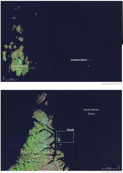
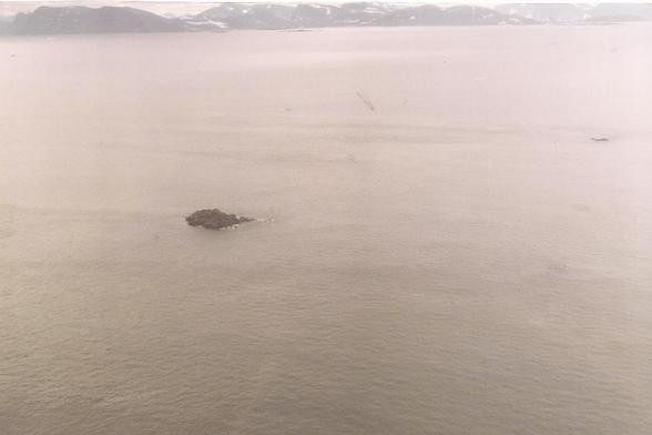
Landsat Island, Discovered 1976
--
https://landsat.gsfc.nasa.gov/article/landsat-island/ <-- shared NASA page
--
#GIS #spatial #mapping #geography #island #Canada #Labrador #LandsatIsland #discovery #landsat #landsat1 #history #coast #coastal #cartography #survey #polarbear #exploration #satellite #earthobservation
--
https://landsat.gsfc.nasa.gov/article/landsat-island/ <-- shared NASA page
--
#GIS #spatial #mapping #geography #island #Canada #Labrador #LandsatIsland #discovery #landsat #landsat1 #history #coast #coastal #cartography #survey #polarbear #exploration #satellite #earthobservation


Landsat Island | Landsat Science
Off the northeastern coast of Labrador, in the northern most reaches of the Newfoundland & Labrador province lies Landsat Island, an icy isle inhabited only by polar bears. How did such a place get named after a satellite? In 1976, Landsat data were used as part of a Canadian coastal survey. The Landsat images revealed