RE: https://en.osm.town/@watmildon/116762597023228933
Ohsome dashboards have refreshed their data up to June 19. Let's goooooooooooooo!
Thanks to everyone who keeps this running!!
RE: https://en.osm.town/@watmildon/116762597023228933
Ohsome dashboards have refreshed their data up to June 19. Let's goooooooooooooo!
Thanks to everyone who keeps this running!!
@pixelpfuscher 😮 Sehr seltsam. Leider konnte ich nicht herausfinden, welche OSM Daten für die Berechnung der Schatten genutzt werden. Vermutlich wurden noch andere Datenquellen verwendet.
"Grundlage der Berechnungen sind hochaufgelöste Schattendaten" https://heigit.org/auf-schattigem-weg-ans-ziel-hitzemeidende-routing-anwendung-fur-viele-deutsche-stadte-verfugbar/
Das geologische Institut der Uni Heidelberg (#HeiGit) hätte gern Aufträge von Kommunen zur Weiterentwicklung des Projekts. Vielleicht tut sich ja noch was.
#OpenStreetMap-Daten als Grundlage für #Routing – wie gut funktioniert das wirklich? :: #FOSSGIS-Konferenz 2026 :: #pretalx
https://pretalx.com/fossgis2026/talk/QKQH9H/
> Das #HeiGIT und das #BKG untersuchen, wie die Qualität von OSM-Daten Routingentscheidungen beeinflusst. Mit der ohsome quality API werden Vollständigkeit, Attributgenauigkeit und Aktualität der Daten analysiert und mit Routingvergleichen zwischen Openrouteservice, #GoogleMaps, #BingMaps und #AppleMaps verknüpft. Die Ergebnisse zeigen robuste OSM-Leistungen und liefern praxisrelevante Erkenntnisse zur Nutzung und Bewertung von OSM-Daten für Routing.

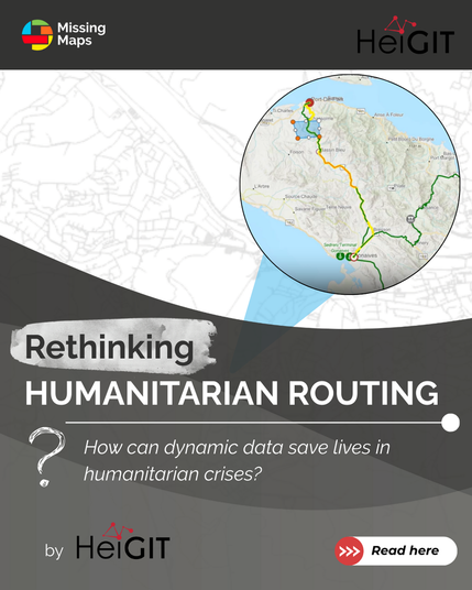
How can dynamic data save lives in humanitarian crises?
When bridges collapse or floodwaters cut critical roads, static routing quickly becomes outdated, slowing down relief when every minute and mile matter.
#HeiGIT, together with the Logistics Cluster, are developing dynamic routing that integrates real-time, mission-specific data from the field directly into route calculations, enabling responders to adapt on the fly and avoid delays.
👉 Read the full article: https://tinyurl.com/4a48y3ch
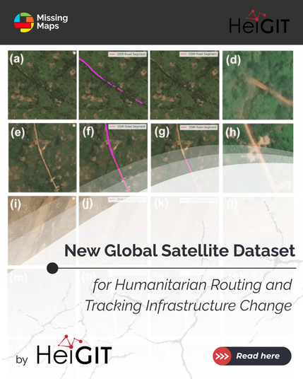
#HeiGIT introduced a new global satellite dataset for humanitarian routing and monitoring. 🎉
The dataset makes it possible to distinguish between paved and unpaved roads worldwide with unprecedented consistency. It enables more accurate routing, accessibility mapping, and infrastructure monitoring - especially in areas with limited ground data.
The dataset is openly available via the Humanitarian Data Exchange (HDX).
👉 Read the full article here https://tinyurl.com/25b6exmn
Retours du State of the Map Europe 2025 | Adrien Pavie
https://pavie.info/blog/retour-sotm-europe-2025/
Les 14 et 15 novembre 2025, le State of the Map Europe s’est tenu à Dundee, en pleine Écosse. L’évènement regroupe la communauté #OpenStreetMap Européenne sur 2 jours pour partager les nouveautés logicielles, les initiatives cartographiques, et adresser de nouveaux défis. J’ai eu la chance d’y participer : voici mes coups de cœur, découvertes, et les tendances qui vont marquer l’écosystème OSM dans les mois à venir.
#sotm #sotmeu #mapyourgrid #panoramax #clearance #heigit #sig #opendata

Les 14 et 15 novembre 2025, le State of the Map Europe s’est tenu à Dundee, en pleine Écosse. L’évènement regroupe la communauté OpenStreetMap Européenne sur 2 jours pour partager les nouveautés logicielles, les initiatives cartographiques, et adresser de nouveaux défis. J’ai eu la chance d’y participer : voici mes coups de cœur, découvertes, et les tendances qui vont marquer l’écosystème OSM dans les mois à venir.
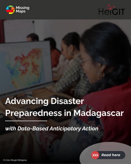
👉 New blogpost by #HeiGIT! Read about strenghtening local GIS capacity for anticipatory action.
ℹ️ In partnership with the Malagasy and German Red Cross, HeiGIT conducted advanced GIS training in Antananarivo, equipping local responders with skills to implement a semi-automated cyclone risk trigger system. This supports the development of Early Action Protocols, enabling proactive interventions before disasters occur.
👉 Full article here: https://tinyurl.com/4bdnkjc9
Amazing collaboration!🙌
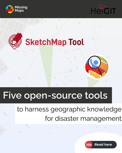
How to effectivey crowdsource geographic knowledge to support disaster management?
#HeiGIT has selected 5 free, open-source services and resources that help integrate VGI (Volunteered Geographic Information) into disaster management.
Thanks to invaluable crowdsourced data like #OpenStreetMap, such tools can support data-driven risk assessments and informed decision-making during crisis.
👉 Read more here: https://tinyurl.com/45vpnz6s
With #OpenStreetMap, anyone can help map their surroundings or crisis-affected areas worldwide to support local responders.
At a recent school workshop led by #HeiGIT, students at the temporärhaus in Ulm (Germany) learned to map buildings using satellite imagery and the HOT Tasking Manager, and how tools like #ohsomeNowStats help analyze and share data.
They also discovered how easy it is to contribute via apps like #StreetComplete and #EveryDoor.
A great initiative! ✨


