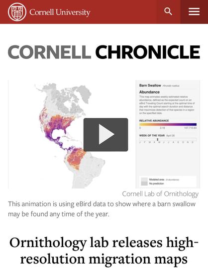
“The eBird program at the Cornell Lab of Ornithology just released 500 animated maps spanning the entire Western Hemisphere.” (March 2020)
https://news.cornell.edu/stories/2020/03/ornithology-lab-releases-high-resolution-migration-maps
#birding #NCed #CLTed #OutdoorEd #GeoMap #visualization #create2learn

Ornithology lab releases high-resolution migration maps | Cornell Chronicle
Combining observations from human bird watchers with topographical information satellites and information about light at night, the Cornell Lab of Ornithology’s eBird program has just released animated migration maps.