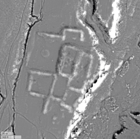
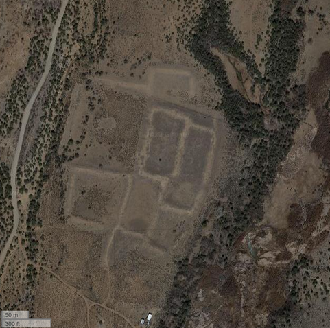
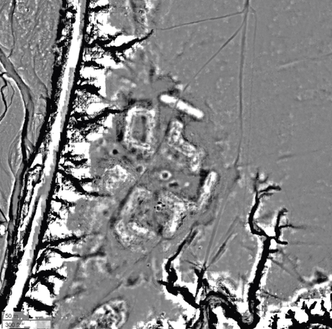
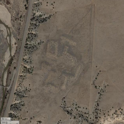
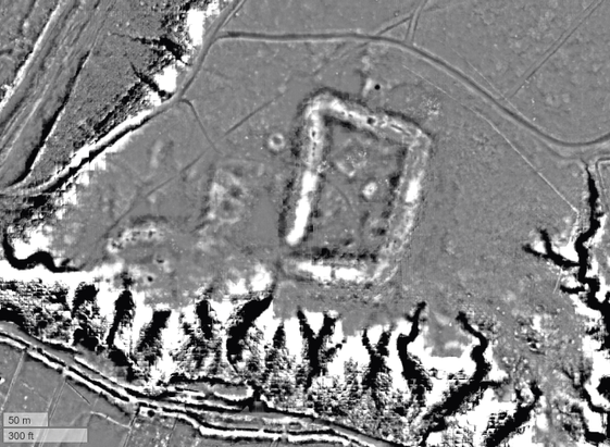
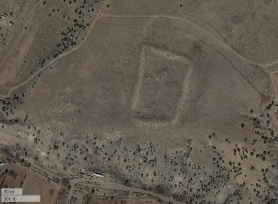
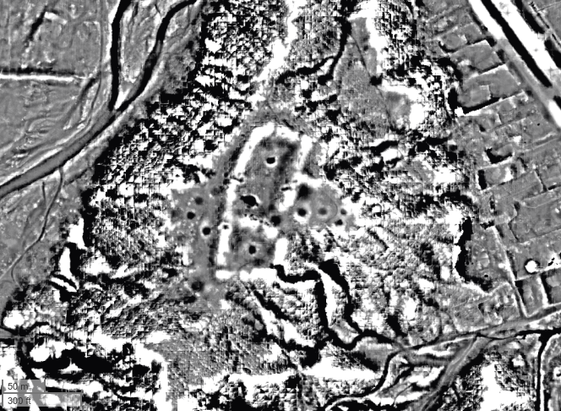
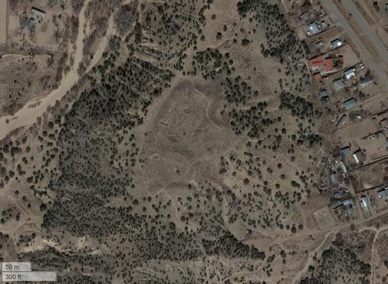
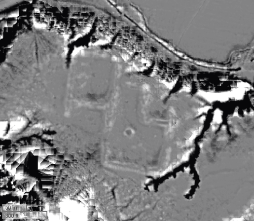
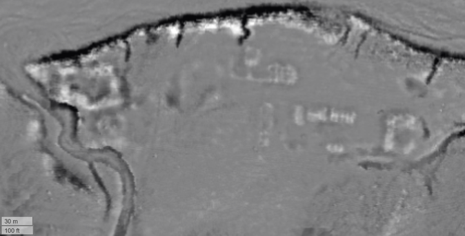
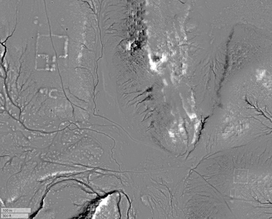
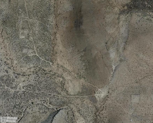
#archaeology #landscapes from #lidar 31

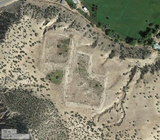
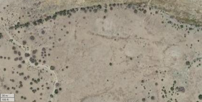
By the time of Spanish colonial arrival in #NewMexico (1590 CE) the #RioChama was mostly abandoned. The inhabitants of the large Classic period villages had moved on to other parts of the Pueblo world, in particular the Rio Grande valley and nearby areas such as the Galisteo Basin. They left behind a well-preserved landscape of villages, shrines, and fields.

Pictured are the Classic sites of Sapawe and Ponsipa'akeri.

#ArchaeologyLandscapeVisualization

#archaeology #landscapes from #lidar 30

The large Classic villages of the #RioChama were part of a larger phenomenon throughout the Pueblo world. Archaeologists refer to this period as Pueblo IV, and it was in this interval from about 1300 CE through the arrival of the Spaniards that the Pueblo societies we know today took shape in terms of settlement, religion, social structure, etc.

Pictured are the Classic sites of Tsama'ouinge and Te'ewi'ouinge.

#ArchaeologyLandscapeVisualization

#archaeology #landscapes from #lidar 29

The #RioChama is a major tributary of the Rio Grande in Northern #NewMexico. Beginning around 1350 CE (the Classic Period) it experienced major population growth and saw the growth of large nucleated villages of 1000+ rooms. Much of this growth was from immigration. These villages were ancestral to the modern Tewa peoples.

The village of Poshu'ouinge is pictured.

https://en.wikipedia.org/wiki/Poshuouinge

https://en.wikipedia.org/wiki/Tewa

#ArchaeologyLandscapeVisualization

Poshuouinge - Wikipedia

#archaeology #landscapes from #lidar 28

Camp Ojo Caliente #NewMexico was established as an outpost of Fort Craig in 1859, and was quickly abandoned in 1861 at the beginning of the Civil War. It was reoccupied from 1879-1882 during the later Apache Wars. The first shots of Victorio's War were fired near here when a band of Apaches attacked the garrison and made off with their horses.

In the image, the camp is on the right and an older Pueblo is on the left.

#ArchaeologyLandscapeVisualization

#archaeology #landscapes from #lidar 27

Fort Craig #NewMexico was built in 1853 and by 1861 had become the largest fort in the Southwest, with a garrison of over 2,000. In 1862 the Confederate Army of New Mexico elected to bypass the fort on its march north to Santa Fe. Between 1863 and 1865 Fort Craig was the US Army headquarters for its prosecution of the Apache Wars. It was abandoned in 1885.

https://en.wikipedia.org/wiki/Fort_Craig

https://en.wikipedia.org/wiki/Apache_Wars

#ArchaeologyLandscapeVisualization

Fort Craig - Wikipedia

#archaeology #landscapes from #lidar 26

Fort Cummings #NewMexico was established at Cooke's Pass to protect the Butterfield Overland stage route and the southern road to California. Between 1848 and 1861 the pass was dangerous for travelers, who were often ambushed and killed by the Apache. The Fort was built in 1863 near a stage stop. It was abandoned in 1873, but was sporadically used again from 1880-1886 during later conflicts with the Apache.

#ArchaeologyLandscapeVisualization

#archaeology #landscapes from #lidar 25

Fort Union, #NewMexico was built in 1851 to protect the Santa Fe Trail. The original fort (on the left in the image) was meant to provide protection from Indian raids and was built at the base of a bluff. When the Civil War broke out, it became obvious that this position was vulnerable to artillery, and the Fort was reconstructed on the open plains (right) and the star fort was constructed. It was abandoned in 1891.

#ArchaeologyLandscapeVisualization

#archaeology #landscapes from #lidar 24

Horse Camp Mill Pueblo, a large nucleated village in west-central #NewMexico. Like the nearby Techado Spring Pueblo featured yesterday, it was destroyed by violence in the early 14th century. The site seems to have been an important node in a regional road network, and was next to the Acoma Salt Trail.

https://www.archaeologysouthwest.org/pdf/arch-sw-v22-no1.pdf, pgs 10-11.

@PattMeeples I'll just keep tagging you on these Cibola sites.

#ArchaeologyLandscapeVisualization

#archaeology #landscapes from #lidar 23

This is Techado Spring Pueblo, a large nucleated village in west-central #NewMexico that was the site of a massacre probably in the early 14th century. Much of the pueblo is burned, and researchers found unburied human skeletal remains and evidence of violent trauma. It is possible that this reflects conflict with migrants fleeing drought further north around this time.

@PattMeeples would know more about this site.

#ArchaeologyLandscapeVisualization

#archaeology #landscapes from #lidar 22

This is Pueblo Blanco (aka Tabirá, aka LA 51), a large late prehistoric, early colonial period village in central #NewMexico. Note the shallow pits surrounding the village, similar to what we saw yesterday at the nearby Pueblo Colorado. Probably adobe borrow pits.

Tabirá was a Piro-speaking town, was the site of a Spanish mission, and was finally abandoned in the 1670s due to raiding by mobile Plains groups.

#ArchaeologyLandscapeVisualization