Woohoo, damage assessments for wildfires may be initiated. This will mean that I pause everything else to lead an assessment team... #2024fireseason #whiplash
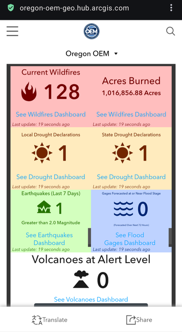
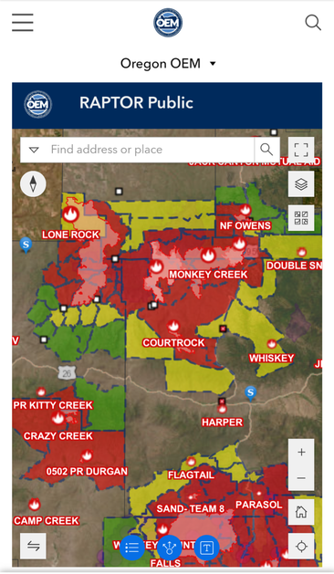
@faerye Hey there, here's a link to the State of Oregon Hazard Analysis Dashboard:
https://oregon-oem-geo.hub.arcgis.com/
No social media, no walled garden. It's mobile accessible, but I recommend using a computer for the best experience.
This is based on real time data and includes evacuation zones. If you click on incidents, it will provide more data and weather reports.
Please share. Let me know if you have issues so my talented colleagues can address them :)