Why bother reviewing then, just reject the paper. 🤨

| Website | https://nicolas.audebert.at |
📝 New paper accepted at VISAPP: https://hal.science/hal-04905572 🎉
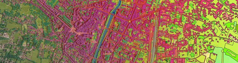
We release 3DSES, a unique indoor Lidar dataset for semantic segmentation and BIM including:
🎨 RGB,
📶 Lidar intensity,
↗️ extreme point density.
Congrats to Maxime who has done a tremendous work capturing, labeling and modeling this data!
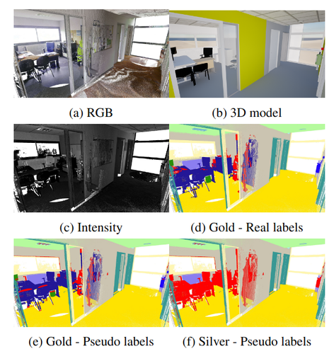
<div><p>Semantic segmentation of indoor point clouds has found various applications in the creation of digital twins for robotics, navigation and building information modeling (BIM). However, most existing datasets of labeled indoor point clouds have been acquired by photogrammetry. In contrast, Terrestrial Laser Scanning (TLS) can acquire dense sub-centimeter point clouds and has become the standard for surveyors. We present 3DSES (3D Segmentation of ESGT point clouds), a new dataset of indoor dense TLS colorized point clouds covering 427 m 2 of an engineering school. 3DSES has a unique double annotation format: semantic labels annotated at the point level alongside a full 3D CAD model of the building. We introduce a model-to-cloud algorithm for automated labeling of indoor point clouds using an existing 3D CAD model. 3DSES has 3 variants of various semantic and geometrical complexities. We show that our model-to-cloud alignment can produce pseudo-labels on our point clouds with a > 95% accuracy, allowing us to train deep models with significant time savings compared to manual labeling. First baselines on 3DSES show the difficulties encountered by existing models when segmenting objects relevant to BIM, such as light and safety utilities. We show that segmentation accuracy can be improved by leveraging pseudo-labels and Lidar intensity, an information rarely considered in current datasets. Code and data will be open sourced.</p><div>
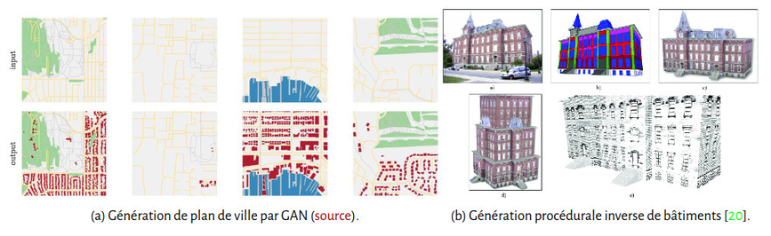
📣 Offre de thèse
🧑💻 Je recrute un⋅e doctorant⋅e en génération de procédurale directe et inverse de plans de ville et de bâtiments. 🏙️
Venez combiner apprentissage profond et grammaires pour créer une nouvelle classe de modèles génératifs hybrides et interprétables ! 🤖
📄 http://audebert.at/files/2025_Th%C3%A8se_deep_procedural_generation.pdf
Si vous êtes prof de CPGE (ou que vous en connaissez), sachez que l'ENSG-Géomatique propose via le LIESSE une formation :
« Intelligence artificielle pour la cartographie » 🤖🗺️ (21/10)
➡️Inscriptions : https://liesse.minesparis.psl.eu/course/view.php?id=200