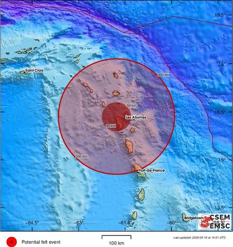
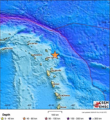
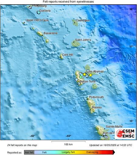
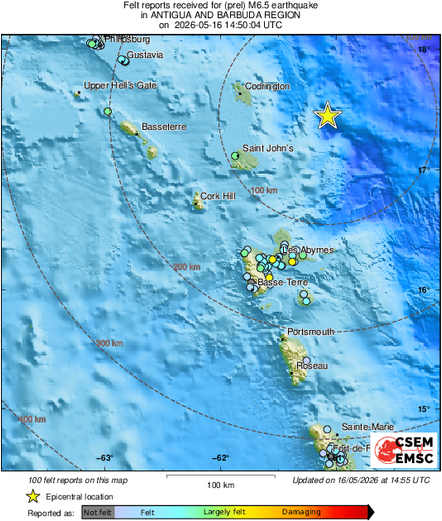
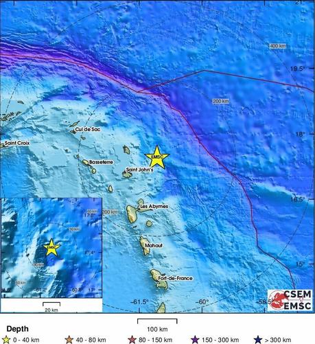
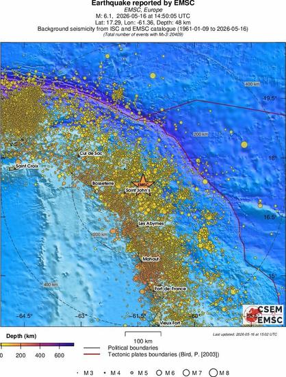
#Earthquake (#séisme) possibly felt 46 sec ago in #Guadeloupe. Felt it? Tell us via:
📱https://m.emsc.eu/#app
🌐https://m.emsc.eu
🖥https://www.emsc-csem.org
⚠ Automatic crowdsourced detection, not seismically verified yet. More info soon!
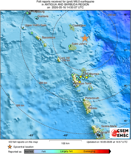
📱https://m.emsc.eu/#app
🌐https://m.emsc.eu
🖥https://www.emsc-csem.org
⚠ Automatic crowdsourced detection, not seismically verified yet. More info soon!