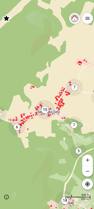
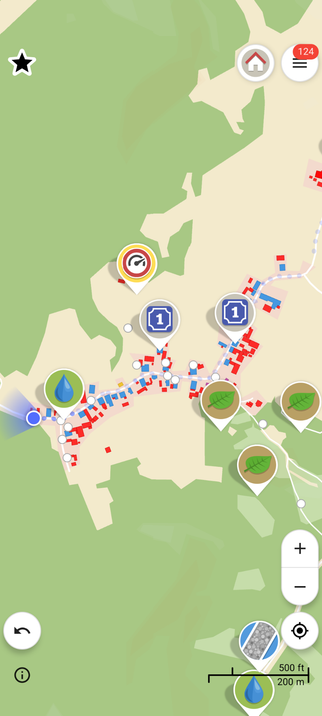
While deciding what to ruck, I noticed that Seljansko Selo in #Croatia has not been mapped yet. So quickly mapped the buildings via JOSM before heading out and doing ground evaluation via #StreetComplete.

In Croatian country side it is best just to denote the residential buildings, since the rest are statistically going to farm buildings.

#beforeandafter #OpenStreetMap

During the planning phase, I try to link up two potential `noexit=yes` highways together, since the likelihood that they are actual no exits is bleak.

Additionally while on the ground, I denote potential paths for future potential exploration and possible obstacles like `waterway=stream` or `waterway=ditch` or `natural=cliff`.

The red route is the planned route whereas the dark purple route is the tracked one.

#OsmAnd #OpenStreetMap #rucking #hiking #exploration #offroad