New 🚲 preprint! https://arxiv.org/abs/2604.07029
Quality assessment of a country-wide bicycle node network with loop census analysis

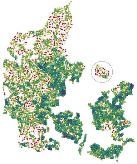
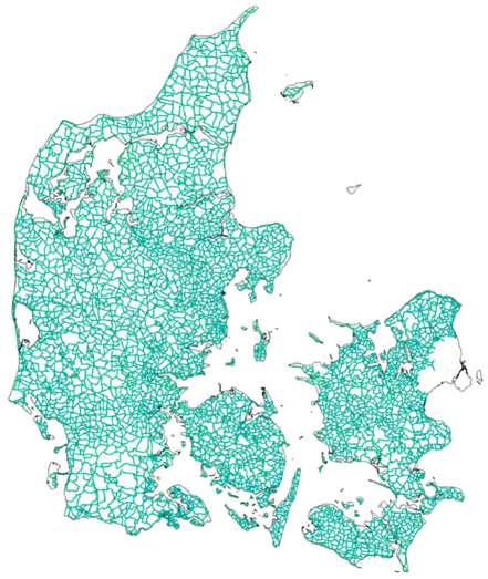
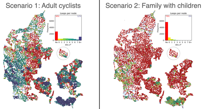
We analyzed the new 30000km long Danish #bicycle node network, exploring all 28M round trips in the network up to day-trip length. 🧵

A bicycle node network has a wayfinding system of numbered nodes for recreational #cycling, on a regional/national scale. We have previously shown on https://bikenetwork.dk/ the low bikeability in #Denmark outside of cities, now improved by the new bicycle node network.
Now we developed the loop census method, which lists each node's loops (cycles) up to day-trip length. We find that long-range cyclists can access most of the country with many choices, but families with small children can not - which could however be overcome by e-bikes.

Together with our previous #qgis BikeNodePlanner tool our work has initiated an #opensource ecosystem for data-driven design and assessment of regional bicycle node networks.
Code: https://github.com/mszell/bikenwloops
Data: https://doi.org/10.5281/zenodo.19222642

With @anavybor @ane Thx to DKNT! Funded by https://www.just-streets.eu/

GitHub - mszell/bikenwloops: Bicycle node network loop analysis

Bicycle node network loop analysis. Contribute to mszell/bikenwloops development by creating an account on GitHub.

GitHub

@mszll @anavybor @ane Thanks for sharing!

Is it fair to say that this roughly measures the density of intersections in the network? Which is an interesting metric but not necessarily ideal:
- on the one hand there might be several POIs (school, shop, ...) on a 10km stretch,
- on the other hand it's not always useful to have 20 intersections on the way when going in a straight line.

I see though that some practical parameters (water sources, slope gradient) are mixed in: https://github.com/mszell/bikenwloops/blob/main/parameters/config.yml

@mszll @anavybor @ane Another interpretation could be: "How many different POIs can one reach within daily cycling distance using the cycling network?"

The cycling network is part of the answer, but the density of POIs as well: it should be clear that in sparse rural areas there are fewer POIs than in dense cities to begin with. It could be interesting to divide the reachable POIs (e.g. within 10km of cycling) by the total number of POIs within a circle of radius 10km.