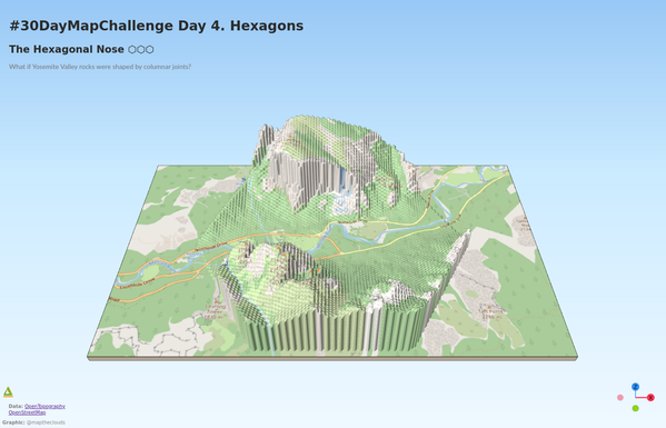
Day 52. The Hexagonal Nose ⬡
For this project, I explored a speculative version of Yosemite: what if El Capitan's Nose route had formed with hexagonal columnar geometry.
The terrain base comes from OpenTopography LiDAR, so the relief and scale remain grounded in real data.
Built with QGIS, Qgis2threejs, and Three.js.
#100DayMapChallenge Day 52/100
#QGIS #ThreeJS #LiDAR #Geospatial #OpenSource
🔗 https://maptheclouds.com/playground/30-day-map-challenge/hexagons/