Ooh, there's where that storm went.
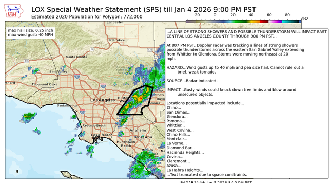
"...Los Angeles County San Gabriel Valley CA-
Eastern San Gabriel Mountains CA-
812 PM PST Sun Jan 4 2026
...A LINE OF STRONG SHOWERS AND POSSIBLE THUNDERSTORM WILL IMPACT EAST
CENTRAL LOS ANGELES COUNTY THROUGH 900 PM PST...
At 807 PM PST, Doppler radar was tracking a lines of strong showers
possible thunderstorms across the eastern San Gabriel Valley extending
from Whittier to Glendora. Storms were moving northeast at 20
mph.
HAZARD...Wind gusts up to 40 mph and pea size hail. Cannot rule out a
brief, weak tornado...."