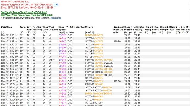
Wanna see near real time wind data? Sure, you can do that. Open the map, click any arrow, follow the link. Each arrow depicts a METAR weather station.
Look closely and you will see that the arrow symbols change size and color based on wind speed.
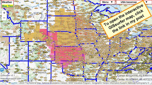
When this map opens it also shows several shaded colors as follows:
Wind advisory - light brown
High wind warning - gold
Red Flag warning - red
#SevereWX #HighWindWarning #RedFlagWarning