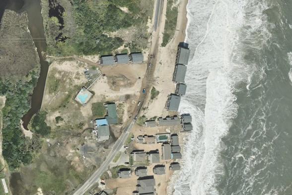
"NOAA’s #NationalGeodeticSurvey is collecting aerial damage assessment images following #HurricaneErin. Imagery is collected by NOAA aircraft in specific areas identified by NOAA in coordination with federal and state partners.
Collected NOAA #EmergencyResponseImagery is available below and new imagery will be posted as soon as it is available."
https://oceanservice.noaa.gov/news/aug25/ngs-hurricane-erin.html

Hurricane Erin: Aerial imagery
NOAA’s National Geodetic Survey (NGS) is collecting aerial damage assessment images following the devastating flooding in the Texas Hill Country in the early hours of Friday, July 4, 2025. Imagery is collected by NOAA aircraft in specific areas identified by NOAA in coordination with FEMA and other state and federal partners.