Today's fascination: indigenous tactile maps.
These are Inuit and were used when kayaking, feeling them as they paddled along.
The middle one is a representation of a number of offshore islands.
https://mastodon.social/media/v6fieaOtlu2TwS6K_y0
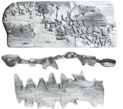
These are Inuit and were used when kayaking, feeling them as they paddled along.
The middle one is a representation of a number of offshore islands.
https://mastodon.social/media/v6fieaOtlu2TwS6K_y0