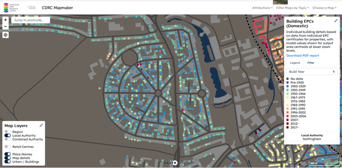
#CDRC have a map of #EnergyPerformanceCertificates (EPC) by #URPN. They display the date the property was built as imputed by the EPC. Lots of amazing inaccuracies.

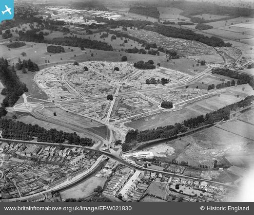
Wollaton Park Estate was built in late 1920s, as shown in contemporary aerial photo from #BritainFromAbove (June 1928).

Links in alt text.

I wrote a little about this area in a couple of blog posts, mainly exploring ideas about how to map change (& how much of it there might be) for #OpenHistoricalMap

http://sk53-osm.blogspot.com/2013/02/persistence-in-urban-environment-1.html

http://sk53-osm.blogspot.com/2014/05/editing-historical-road-layouts.html

Persistence in the Urban Environment : 1

Anyone reading this blog should have realised that I am interested in using maps to understand how the environment we live in has changed...

John Boughton (Muncipal Dreams) included in his 100 estates representing the history of British Council Housing, and wrote it up on his blog in June 2018 https://municipaldreams.wordpress.com/2018/06/19/8951/
Nottingham’s Council Housing by Bus and Tram

Municipal Dreams
@SK53 today I learned that neither @Tusky Firefox for Android, nor Chrome allow you to copy text from the alt text on an image.