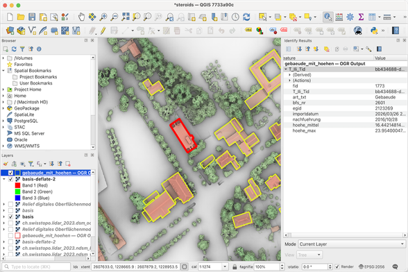
Raster-enabling Apache Hop: @edigonzales continues his series on #geoenabling #ApacheHop, this time adding #raster support to his hop-gdal-plugin. Stefan walks through an #ETL pipeline that computes building heights from LiDAR and vector data using new raster transforms...
https://spatialists.ch/posts/2026/04/03-raster-enabling-apache-hop/ #GIS #GISchat #geospatial #SwissGIS
https://spatialists.ch/posts/2026/04/03-raster-enabling-apache-hop/ #GIS #GISchat #geospatial #SwissGIS
Raster-enabling Apache Hop – Spatialists – geospatial news
Stefan Ziegler continues his series on #geoenabling #ApacheHop, this time adding #raster support to his hop-gdal-plugin. Stefan walks through an #ETL pipeline that computes building heights from LiDAR and vector data using new raster transforms (Raster Clip, Raster Zonal Stats) built on the newer #GDAL tool structure.