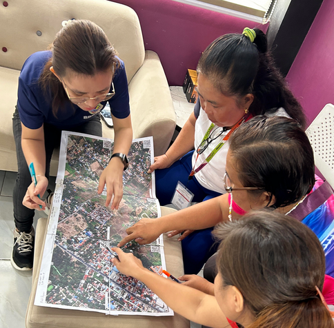
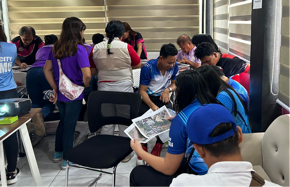
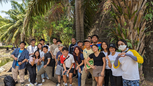
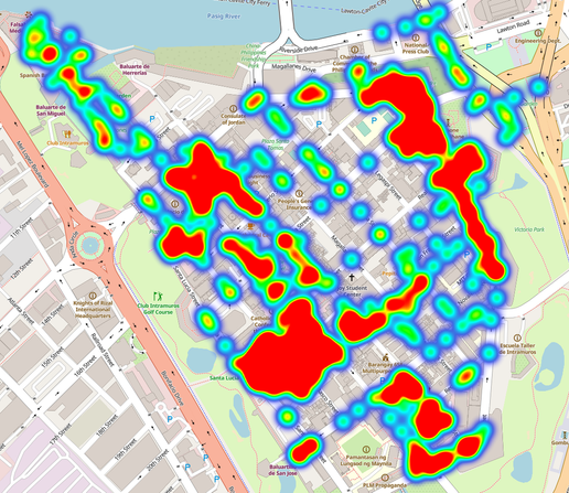
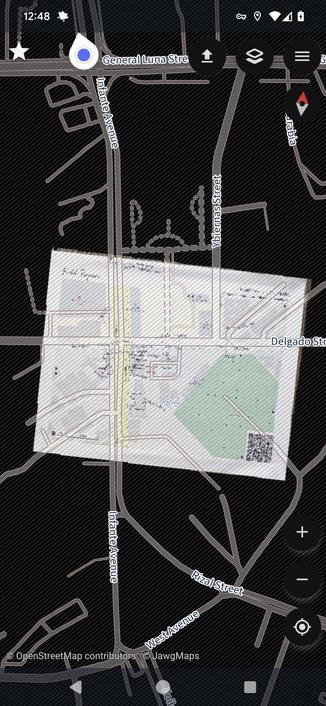
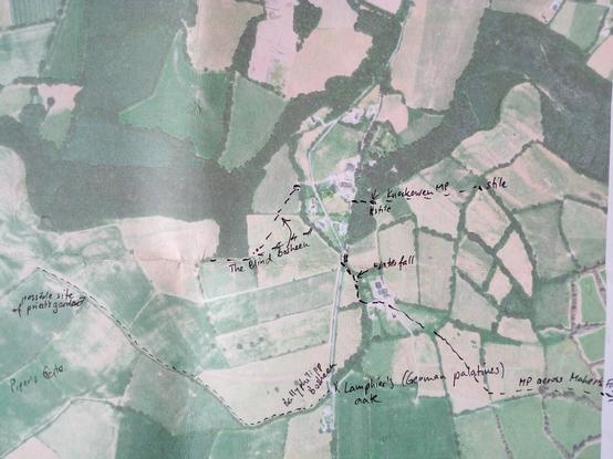
Some photos from a municipality in the #Philippines, who's been using #FieldPapers for their #DisasterPreparedness activities, involving various stakeholders, and utilizing aerial images from their own drones.

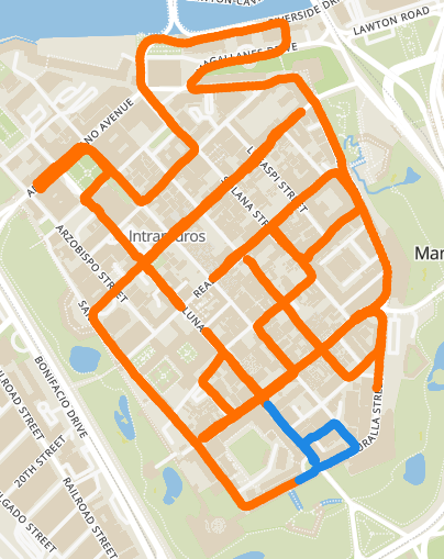
The data they collect will eventually be uploaded to #OpenStreetMap

@BUnicycling

At this point, no. #FieldPapers will remain as your only option for that.

@heigit

The @pinoy @OSM—PH communities in #Manila , #Philippines got together last Sunday, for a field mapping party ("AlayData"), celebrate #OpenDataDay, and got to play with the #SCEE app (a fork of #StreetComplete) and #FieldPapers , while another team opted to collect ground level photos for #Panoramax.

While most of the folks have experience with #OpenStreetMap mapping, we had a couple of novice participants, who seemed to have enjoyed it as much as we did.

We ought to do this more often.

@MapAmore

The #StreetComplete fork called SCEE, for "experienced editors" supports custom tile layers.

Though there's a bug on the UI that refers to the custom layer by it's default name. Otherwise, it works.

See attached screenshot of the #SCEE app, with a #FieldPapers tile as background.

@vespucci_editor @osmandapp @openstreetmap

Met some farmers yesterday to get information about mass paths. Result: 4 more mass paths leading to Freshford:
http://overpass-turbo.eu/s/1AVj
#masspath #OpenStreetMap #fieldpapers
overpass turbo

A web based data mining tool for OpenStreetMap which runs any kind of Overpass API query and shows the results on an interactive map.

After preparing the #fieldpapers and conducting the #hedgerow survey in the field, in this video, I'm transferring the data onto #OpenStreetMap: https://youtu.be/7U_dUC2TmdM #OpenData #biodiversity #wikidata
Hedgerow survey 3: Transferring data to OpenStreetMap

YouTube
2nd part of the hedgerow video series is now finally available. Sorry about the shakiness, my gimbal doesn't do a great job: https://youtu.be/x1tFQLjqPbk
#hedgerow #fieldpapers
Hedgerow survey 2 - Survey in the field

YouTube
This week we're at the @OpenStreetMapUS State of Map US conference! We've got four great presentations lined up about Full Stack Cartography, Field Papers, Vector Tile Engineering, and our recent work designing basemaps for Amazon Location Services! Read our blog post for more about these talks: https://stamen.com/stamen-at-state-of-the-map/ #OpenStreetMap #StateOfTheMap #SOTMUS #cartography #FieldPapers
Stamen at State of the Map | Stamen

This week, Stamen will be attending the State of the Map US conference in Richmond, Virginia! We’ve been attending these OpenStreetMap conferences (either the international State of the Map or this US-based version) for over a decade, and it’s always exciting to feel the energy of this lively community of open source mappers. The OpenStreetMap...

Stamen

If you've been using #OpenStreetMap for a while, you might have heard of the tool called #FieldPapers, which lets mappers collect geodata the old school, low-tech way -- pen and paper.

It's easy to use, and requires very little training

The smart folks at @heigit improved on that idea with their new #SketchMap tool

RT https://mapstodon.space/@heigit/110417165953530309

HeiGIT (@[email protected])

📝HeiGIT showcased the Sketch Map Tool as a means to digitalize #mapping initiatives that can reduce risks & improve community resilience in regard to #climate change, natural disasters & urban challenges. 💻 Read more: https://heigit.org/training-on-digitalization-of-participatory-mapping-in-kuala-lumpur/ #gis #gischat #geospatial #osm #openstreetmap #OpenScience #OpenSciTalk (2/2)

Mapstodon
In case you missed the announcement: We're excited to transition the Field Papers project into the stewardship of @OpenStreetMapUS for the ongoing benefit of the #OpenStreetMap community at large. After 11 years and more than 3 million maps, we're looking forward to seeing #FieldPapers continue to thrive under new management! https://stamen.com/a-new-home-for-field-papers/
A New Home for Field Papers | Stamen

By Jess Beutler (OpenStreetMap US) and Alan McConchie (Stamen Design)  OpenStreetMap US is excited to announce the adoption of Field Papers into the suite of tools we support for the larger OSM community. Over the course of 2023, Stamen and OpenStreetMap US will be working together on this transition and develop a plan for sustainable...

Stamen