it's been a week now that the image server of Curiosity hasn't updated, so let's go for some old ones
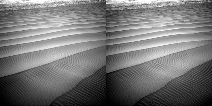
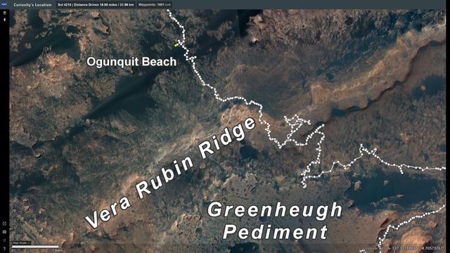
Check out this 3D view of the dune field by the Ogunquit Beach site, in the north of the Vera Rubin Ridge, captured 7 years ago, February 6, 2017 (Sol 1601)
to go 3D: eyes' lines of sight parallel/left image for left eye/right image for right eye
Credit images: NASA/JPL-Caltech
#Mars #Curiosity #Sol1601 #Dune #OgunquitBeach #rover #CuriosityRover #3D #Stereo3D #stereoscopic #images #Astrodon