ESA SNAP got updated.
Now #Sentinel2C data is supported, the Sen2Coral plugin is available and BandGroups have been added to the PinManager. Also, some issues have been fixed. See the changelog:
https://step.esa.int/main/public-roadmap-and-changelog
ESA SNAP got updated.
Now #Sentinel2C data is supported, the Sen2Coral plugin is available and BandGroups have been added to the PinManager. Also, some issues have been fixed. See the changelog:
https://step.esa.int/main/public-roadmap-and-changelog
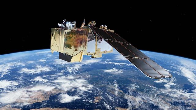
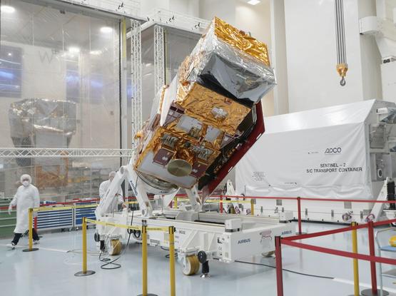
🌍 Exciting! The ESA Sentinel-2C satellite has been launched to enhance the Copernicus program. 🚀 It will provide high-resolution optical images for:
🔍 Land use & change: Track deforestation, urban growth, and agriculture
🌾 Agriculture & Forestry: Insights into vegetation health to optimize yields
🏞️ Disaster response: Monitor floods, fires, landslides for timely action
🏙️ Urban planning: Aid in resilient infrastructure development
#EarthObservation #Sentinel2C #ESA #Copernicus #Sustainability


ESA Impact is out! The latest edition features the historic first flight of #Ariane6, plus #Sentinel2C, #EarthCARE and the #ArcticWeatherSatellite. Don’t miss the views of Earth and the Moon from @ESA_JUICE and Mercury close-ups from @BepiColombo! 👇 🔗https://t.co/bWUxaRrX2c
Satélite Sentinel-2C capta imagem impressionante da Lua
Em 20 de setembro, o satélite Copernicus Sentinel-2C capturou sua primeira imagem impressionante da Lua, obtida ao rolar o satélite para os lados em uma manobra única. Embora o Sentinel-2C seja projetado para observação da Terra, esta imagem – destinada à calibração e comparações entre missões – superou as expectativas.
A imagem, com uma resolução impressionante de cerca de 5 km, revela características lunares notáveis, incluindo a cratera Copernicus, a cratera Tycho e os mares lunares: o Mar da Tranquilidade, o Mar da Umidade e o Mar das Nuvens. Isso mostra a versatilidade do gerador de imagens multiespectrais do Sentinel-2C, que geralmente opera a partir de sua órbita de 786 km para capturar dados de alta resolução da terra e das águas costeiras da Terra.
A imagem lunar é parte de um processo regular de ‘calibração da Lua’. Aproximadamente uma vez por mês, o satélite irá rolar para o lado para obter imagens da Lua em vez da Terra. A intensidade de luz estável e bem conhecida da Lua nos permite detectar e corrigir até mesmo as menores mudanças no desempenho do instrumento, que podem ocorrer devido ao envelhecimento, como degradação do revestimento óptico ou desvios do detector.
Esse processo garante que a ‘precisão radiométrica’ dos dados permaneça precisa durante toda a missão, um parâmetro crítico para muitas aplicações.
Os dados brutos inicialmente exibiam uma Lua alongada, em forma de eclipse, causada pelo movimento relativo entre a Lua e o satélite. Uma correção desse efeito foi realizada para concretizar essa imagem fantástica.
Lançado em 5 de setembro de 2024, o Sentinel-2C se junta aos seus satélites gêmeos em órbita, continuando a fornecer imagens valiosas de alta resolução para o programa Copernicus.
#astronomia #Ciência #CopernicusSentinel2C #crateraCopernicus #crateraTycho #Lua #MarDaTranquilidade #MarDaUmidade #MarDasNuvens #maresLunares #Sentinel2C

On 20 September, the Copernicus Sentinel-2C satellite captured its first stunning image of the Moon, achieved by rolling the satellite sideways in a unique manoeuvre. Although Sentinel-2C is primarily designed for Earth observation, this image – intended for calibration and cross-mission comparisons – exceeded expectations.
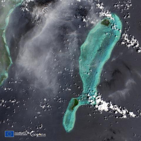
Awesome new satellite images, including of Donana
https://www.esa.int/Applications/Observing_the_Earth/Copernicus/Sentinel-2/Sentinel-2C_delivers_stunning_first_images
#donana #sentinel2c #remotesensing

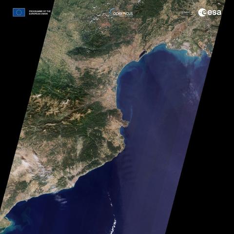
Less than two weeks after being launched into orbit, Sentinel-2C has delivered its first images. These spectacular views of Earth offer a sneak peek at the data that this new satellite will provide for Copernicus – Europe’s world-leading Earth observation programme.