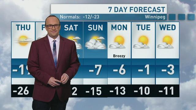
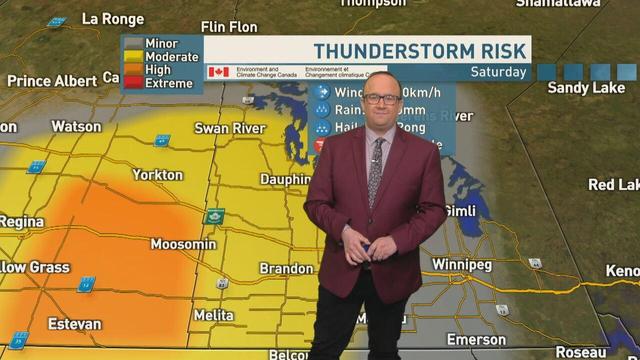
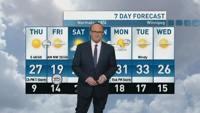
Heat warnings have been issued for the Red River Valley and the Interlake ahead of a weekend where temperatures will exceed 30 C. There is a risk of thunderstorms in Westman.
https://www.cbc.ca/player/play/9.7225941?cmp=rss
It's been windy AF around here. Dust Bowl worries.
“It's considered a non-renewable resource, just because it takes so long to build,” University of Minnesota Extension Educator Angie Peltier said. “And unfortunately, as we've seen, it can take next to no time to lose.”
https://www.mprnews.org/story/2026/05/24/red-river-valley-farmers-worry-as-strong-winds-cause-dust-storms-threaten-their-soil
Wind will be the story of the day on Thursday, with gusts in excess of 60 km/h in the forecast for the Red River Valley and much of the south. The north gets a bit of rain overnight into Friday morning.
Winnipeg and the Red River Valley has a chance for another dusting of snow overnight into Saturday. Temperatures remain above seasonal until early next week.
Winnipeg and the Red River Valley can expect another chilly day, with a highs forecast around –19 C on Thursday. Clouds build in the west, ahead of flurries on Friday. Temperatures are forecast to be warmer than seasonal starting on Friday.
A blizzard warning remains in effect for Winnipeg, the Red River Valley and the Interlake Friday morning with forecast wind gusts this afternoon potentially reaching 90 km/h. Conditions will improve into Saturday.
A short-lived warm up is ahead for much of Manitoba on Wednesday. In the north, expect a steadier snow along the Hudson Bay coast, with a chance of flurries in the Red River Valley. Temperatures are forecast to dip below seasonal again on Sunday.
More snow is on the way for much of Manitoba. An incoming low pressure system will bring snow to the western side of the province beginning late Friday, while the Red River Valley and Winnipeg can expect periods of snow through the day on Saturday.