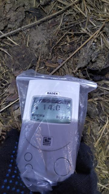
Invisible danger. It's relatively safe to be about 2 hours in such conditions. But the average value is about 1 uSv/h over there.
.
Небяспека, якую не пабачыш. У такіх умовах можна прабыць каля 2 гадзін без істотных наступстваў. Але ў сярэднім па вёсцы ўзровень радыяцыі каля 1 мкЗв/г. Гэта ў тры разы вышэй за норму.
.
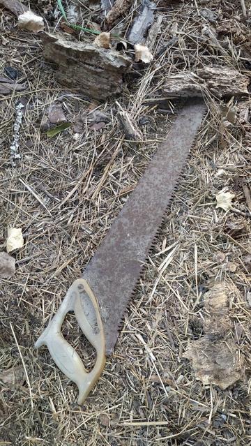
#chernobyl #pollution #danger #radiation #abandoned #village #reserve #urbex #zone #disaster #tool #finds #nuclear #чернобыльскаязона #пгрэз #заповедник #сарай #абандон #хлеў #піла #пила #авария #катастрофа #хойники #погонное #бруд #наступствы #ussr #soviet #советское #загрязнение #radex #radiometry

DART radiative transfer model (Earth sciences 🌍)

DART is a 3D radiative transfer model, designed for scientific research, in particular remote sensing. Developed at CESBIO since 1992, DART model was patented in 2003. It is freeware for scientific activities.

https://en.wikipedia.org/wiki/DART_radiative_transfer_model

#DartRadiativeTransferModel #Radiometry #EarthSciences #RemoteSensing #ScientificModels #AtmosphericRadiation

DART radiative transfer model - Wikipedia

#Conference | #EOSAM24

The #EOSAM24 will take place in Napoli, Sept 9-13! Perfect opportunity to re-discover
‘Radiometry of wet surfaces’, directed by Lionel Simonot.

➡️Program: https://bit.ly/4dxOy8x
📖Book: https://bit.ly/3WfjaD7

#GDRAppamat
#InstitutOptique
#PhotonicsWest
#Radiometry
#EDPSciences

EOS Annual Meeting (EOSAM) 2024

Sea ice concentration (Remote sensing 🛰️)

Sea ice concentration is a useful variable for climate scientists and nautical navigators. It is defined as the area of sea ice relative to the total at a given point in the ocean. This article will deal primarily with its determination from remote sensing measurements.

https://en.wikipedia.org/wiki/Sea_ice_concentration

#SeaIceConcentration #SeaIce #Radiometry #RemoteSensing

Sea ice concentration - Wikipedia

DART radiative transfer model (Remote sensing 🛰️)

DART is a 3D radiative transfer model, designed for scientific research, in particular remote sensing. Developed at CESBIO since 1992, DART model was patented in 2003. It is freeware for scientific activities.

https://en.wikipedia.org/wiki/DART_radiative_transfer_model

#DartRadiativeTransferModel #Radiometry #EarthSciences #RemoteSensing #ScientificModels #AtmosphericRadiation

DART radiative transfer model - Wikipedia

when Radio met Trick
they went logarithmic
with nuclear decay
their love shined
half a lifetime away

#poetry
#radiometry
#dating
#carbon14
#potassium40
#uranium238
#geology
#geochrony

Sea ice concentration (Remote sensing 🛰️)

Sea ice concentration is a useful variable for climate scientists and nautical navigators. It is defined as the area of sea ice relative to the total at a given point in the ocean. This article will deal primarily with its determination from remote sensing measurements.

https://en.wikipedia.org/wiki/Sea_ice_concentration

#SeaIceConcentration #SeaIce #Radiometry #RemoteSensing

Sea ice concentration - Wikipedia