#DronePhotography is more than stunning aerial perspectives of our Earth...
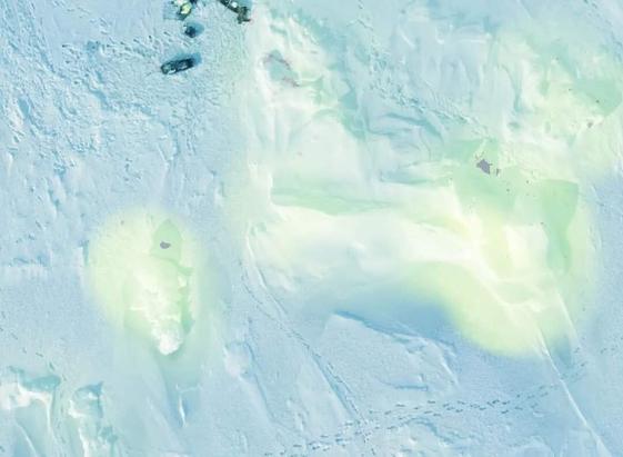
Here, imagery from an #ANAFIUSA drone is put to work understanding sea ice morphology - the shapes of an ephemeral snow-and-icescape captured around May 2021.
Processed into 3D datasets using #OpenDroneMap, then analysed using #PDAL to identify structure. Lighter green in this image means "more complex in 3 dimensions", blue hues are "less complex".
It's a proxy for ridge and deformation finding when absolute elevation isn't able to be hyper-accurate. This in turn tells us about the spatial distribution of physical and ecological processes.
All using a backpackable drone system, clever planning and open source geospatial tools.
#Arctic #SeaIce #PolarResearch #PolarSystems #DronePhotography #OpenDroneMap #FOSS4G