Nelson)
This public consultation process for proposed cycleways in Nelson is cool, and they use MapBox as the map, which is directly based on #OpenStreetMap. This means that all the #OSM improvements me and a few others have made over the last several years, especially separated paths and #micromapping, is on full display! It makes the interactive map more useful because it's easy to identify where paths and crossings are, and areas are accurate and look very nice.

It's the little things that count.
(also google maps still doesn't have it)
#OSMNelson #OpenStreetMap #OSM
(also google maps still doesn't have it)
#OSMNelson #OpenStreetMap #OSM

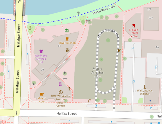
There is ongoing construction work for the new Nelson Bus Hub at Millers Acre, so I've made the building very detailed. Looking forward to micromapping the rest when it's nearly finished. 
#OpenStreetMap #OSM #OSMNelson #Nelson #WhakatūNelson #MicroMapping
#OpenStreetMap #OSM #OSMNelson #Nelson #WhakatūNelson #MicroMapping
Successfully migrated the OSM Nelson website from Glitch hosting to a different company, and bought a new domain name:
https://osmnelson.info
It comes with the added benefit of using it with email, and looking like a more legitimate organisation.
#OSMNelson #OSM #Glitch #Email #Hosting
Got to find a new host for the OSM Nelson website, as Glitch is shutting down services:
https://blog.glitch.com/post/changes-are-coming-to-glitch/
Might be a good time to register a proper domain for it as well.
#OSMNelson #Glitch #WebHosting

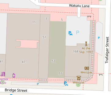
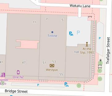
Two weeks ago a new building construction was completed, and now is updated on OpenStreetMap. Google Maps' buildings are still very inaccurate and don't show the change except for the relocation of Westpac.

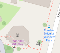
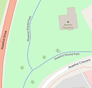
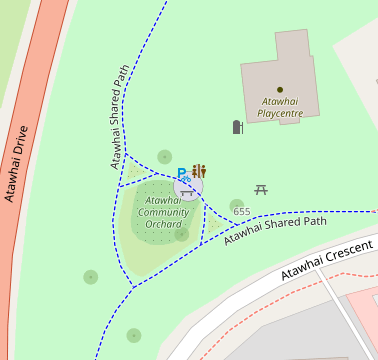
I noticed a new area when I went out to Atawhai a few days ago, took some photos of it and have now mapped it on OpenStreetMap!
Recently I went for a walk around Fairfield park, and with my phone GPS tracking with OSMTracker I walked along every track in the park. Now today I've used that data to update the map in #OSMNelson. Here's a before and after.
#OpenStreetMap #GPSTracking #OSMTracker #OSM
#OpenStreetMap #GPSTracking #OSMTracker #OSM


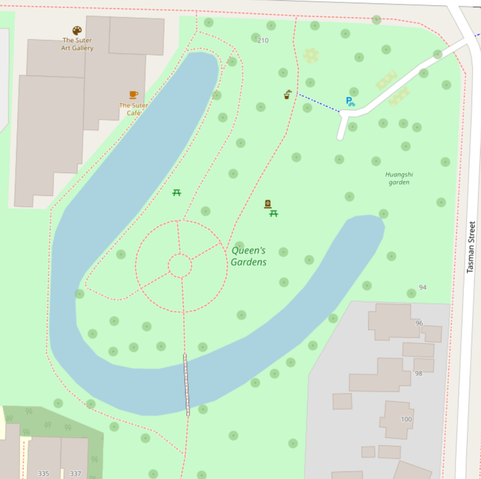
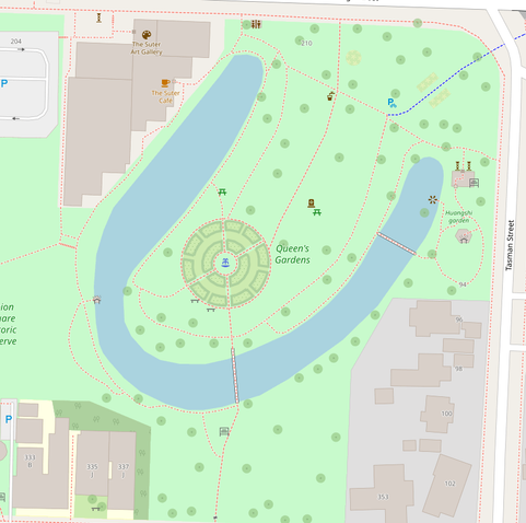
I forgot to clear the cache for the website, so confused myself that the map wasn't re-rendering the new data. Anyway, now here's the before / after screenshots for Queens Gardens.
#OSMNelson #OpenStreetMap #MicroMapping @libroraptor
#OSMNelson #OpenStreetMap #MicroMapping @libroraptor
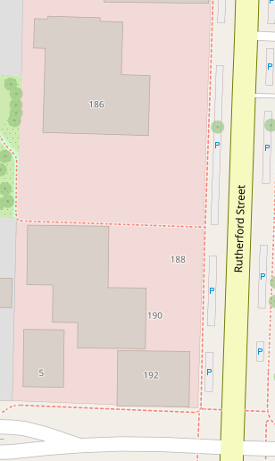
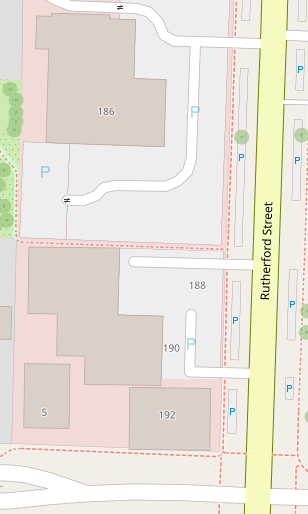
So in order to prove a point about #WhakatūNelson being too car-centric, I'm gonna make sure most of the surface level parking - street-side, lot and private - is mapped in #OSMNelson to accurately illustrate "heres a building, and here's the same size of land as car parking for that building".
#OpenStreetMap #CarDependency #Aotearoa
#OpenStreetMap #CarDependency #Aotearoa