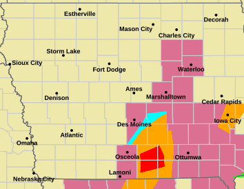
Most of Iowa is under a severe thunderstorm watch right now with several thunderstorm warnings currently in effect. Map updated at 7:56 pm.
Most of Iowa is under a severe thunderstorm watch right now with several thunderstorm warnings currently in effect. Map updated at 7:56 pm.
KCCI just said the last remaining tornado warning from NWS has been cancelled.
I have confirmed that there are no warnings on the NWS page. Looks like the most severe weather is over for the evening.
KCCI 8-2 just ended their weather coverage and reverted to regularly scheduled programming (Golden Girls).
https://forecast.weather.gov/wwamap/wwatxtget.php?cwa=DMX&wwa=tornado%20warning
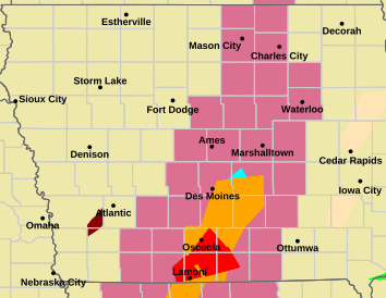
KCCI is saying in a guarded way that the storm they are tracking at the moment has mostly “overrun” the only open tornado warning area, but it remains open until 10 pm. KCCI is saying the rotation has reduced. They are hinting they think the NWS may cancel the warning, but it remains open.
KCCI is saying the overall storm strengths are declining. They are still monitoring, but it sounds like the danger levels overall are greatly decreased. The strongest rotation they are monitoring is approaching Chariton, Iowa.
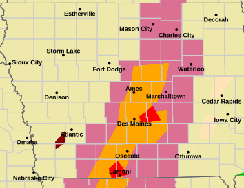
KCCI is saying there was straight line wind of 70 MPH measured at Lamoni Airport. Straight line winds that strong can cause tornado-like damage.
The National Weather Service in Des Moines has issued a
* Tornado Warning for...
Southwestern Lucas County in south central Iowa...
Northern Decatur County in south central Iowa...
Northwestern Wayne County in south central Iowa...
Eastern Clarke County in south central Iowa...
* Until 930 PM CDT.
* At 839 PM CDT, a severe thunderstorm capable of producing a tornado
was located near Van Wert, or 7 miles northwest of Leon, moving
northeast at 35 mph.
A new warning in south central Iowa
...A TORNADO WARNING REMAINS IN EFFECT UNTIL 900 PM CDT FOR
SOUTHWESTERN DECATUR AND SOUTHEASTERN RINGGOLD COUNTIES...
At 826 PM CDT, a severe thunderstorm capable of producing a tornado
was located over Kellerton, or 9 miles east of Mount Ayr, moving
northeast at 40 mph.
HAZARD...Tornado.
https://forecast.weather.gov/wwamap/wwatxtget.php?cwa=DMX&wwa=tornado%20warning