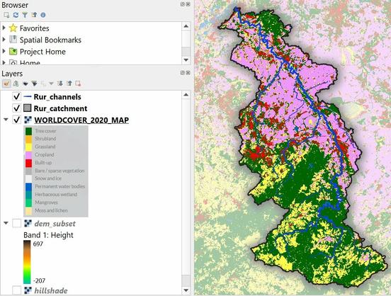
Download and Style CORINE Land Cover Data in QGIS

Download and Style CORINE Land Cover Data in QGIS
RT by @CopernicusEU: 🗺️#CORINE Land Cover 2018 #CLC🌲
👉 Country: #Germany 🇩🇪
🌐 Source: #CopernicusLand Monitoring Service
➡️ Web Site: https://land.copernicus.eu/en/products/corine-land-cover
[2024-03-12 10:56 UTC]
RT Copernicus Land Monitoring Service
🌿How can land cover & land use information benefit #ecologists?
Data products like #CORINE Land Cover (CLC) & High-Resolution #Snow & #Ice (HRSI) ❄ have proven to be a significant help in bird behaviour 🐦 & conservation studies 🏞️
More👉https://lnkd.in/dph59agy
🐦🔗: https://n.respublicae.eu/CopernicusLand/status/1684843669445046272