BakersRelay signing off for the night. If you are interested in one the events below, please follow its hashtag for updates.
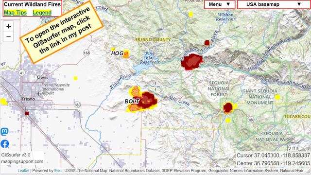
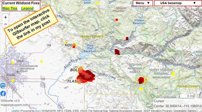
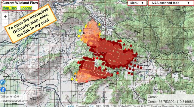
#HurricaneBeryl - Atlantic #GrapeFruitComplex - Alaska #McDonaldFire - Alaska #RileyFire - Alaska #BasinFire - California #flash/BoltFire #FlashFire #BoltFire - California
#ThompsonFire - California #OakRidgeFire - Colorado #SouthForkFire - New Mexico #SaltForkFire. - New Mexico
Be safe, be prepared, be weather aware. I’ll catch you tomorrow morning.