#BIS #NDwx 349
FLUS43 KBIS 191841
HWOBIS
Hazardous Weather Outlook
National Weather Service Bismarck ND
141 PM CDT Tue May 19 2026
NDZ005-013-023-025-036-037-046>048-050-051-201845-
Rolette-Pierce-Wells-Foster-Kidder-Stutsman-Emmons-Logan-La Moure-
McIntosh-Dickey-
141 PM CDT Tue May 19 2026
This Hazardous Weather Outlook is for portions of north central
North Dakota, south central North Dakota, and southeast North
Dakota.
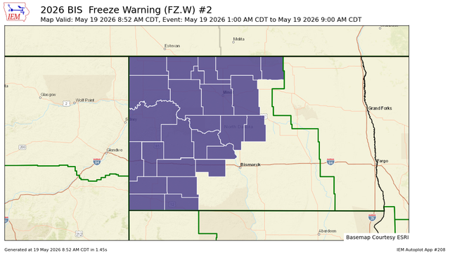
.DAY ONE...This Afternoon and Tonight
Fre https://mesonet.agron.iastate.edu/p.php?pid=202605191841-KBIS-FLUS43-HWOBIS