A year ago, @giacomo and I presented Vantage, a Platform for photo- and video-based spatial reconstruction for investigative journalism, which we have been working on with the support of @PrototypeFund
Today, we’re relaunching Vantage as a toolkit!
| website | https://fidel.computer |
| website | https://krisenstab.net |
A lot is happening in spatial computing at the moment. We are eager to add new tools and features.
We already have a prototype introducing support for gaussian splats in the making 🤫
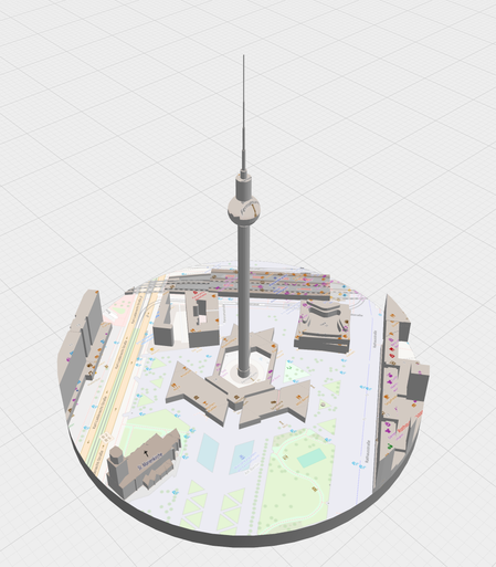
We introduce Territory, our tool for creating textured 3d models, from OSM data, XYZ Tile Layers, public elevation model data.
https://v-a-n-t-a-g-e.github.io/territory/
You can use that to quickly create and customise models for vantage. Of course, you can also use your existing tools for creating 3D models (we currently support .glb/.gltf) or use and customise models you create with Territory in other tools
A year ago, @giacomo and I presented Vantage, a Platform for photo- and video-based spatial reconstruction for investigative journalism, which we have been working on with the support of @PrototypeFund
Today, we’re relaunching Vantage as a toolkit!
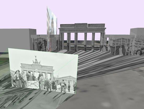
Another attemt at crossing image segmentation with spatial reconstruction.
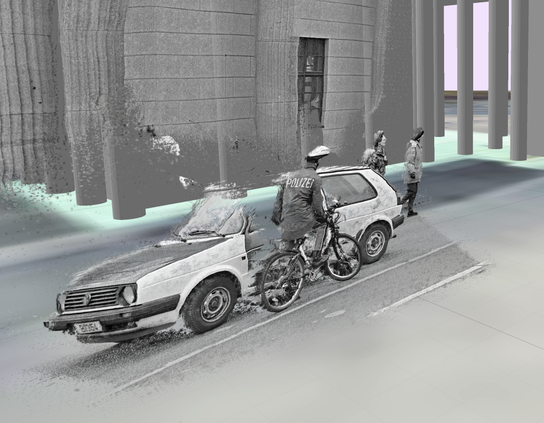
Looking for strategies to reduce noise / floating points. Any ideas?


