A year ago, @giacomo and I presented Vantage, a Platform for photo- and video-based spatial reconstruction for investigative journalism, which we have been working on with the support of @PrototypeFund
Today, we’re relaunching Vantage as a toolkit!
| website | https://fidel.computer |
| website | https://krisenstab.net |
A lot is happening in spatial computing at the moment. We are eager to add new tools and features.
We already have a prototype introducing support for gaussian splats in the making 🤫
Wonder how to get started? We published our first guide: https://open.substack.com/pub/krisenstab/p/performing-a-spatial-reconstruction
Wonder how our tools work? the Vantage toolkit is of course open source: https://github.com/v-a-n-t-a-g-e
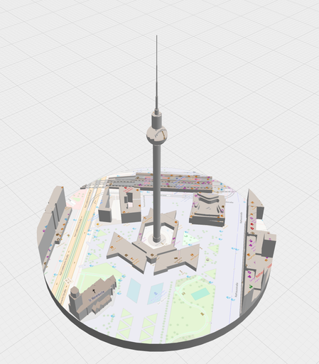
We introduce Territory, our tool for creating textured 3d models, from OSM data, XYZ Tile Layers, public elevation model data.
https://v-a-n-t-a-g-e.github.io/territory/
You can use that to quickly create and customise models for vantage. Of course, you can also use your existing tools for creating 3D models (we currently support .glb/.gltf) or use and customise models you create with Territory in other tools
We are kicking things off with three tools: At the center of our toolkit and still called Vantage, our interface for aligning and projecting imagery onto 3d environments.
https://v-a-n-t-a-g-e.github.io/vantage/
This, and potentially all our future tools, now runs fully in the browser. This makes maintenance so much easier (and cheaper) for us. It also means your data stays on your machine and you can start immediately without setting up an account
A year ago, @giacomo and I presented Vantage, a Platform for photo- and video-based spatial reconstruction for investigative journalism, which we have been working on with the support of @PrototypeFund
Today, we’re relaunching Vantage as a toolkit!
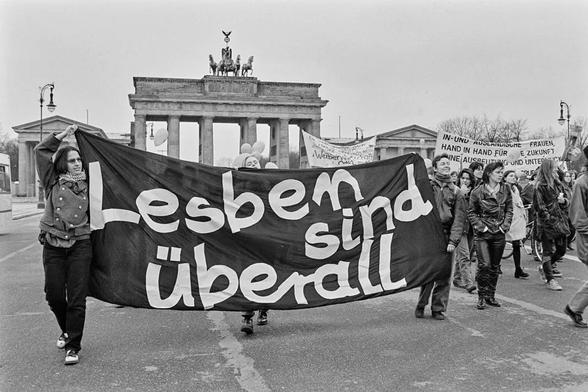
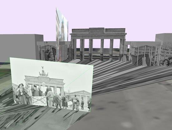
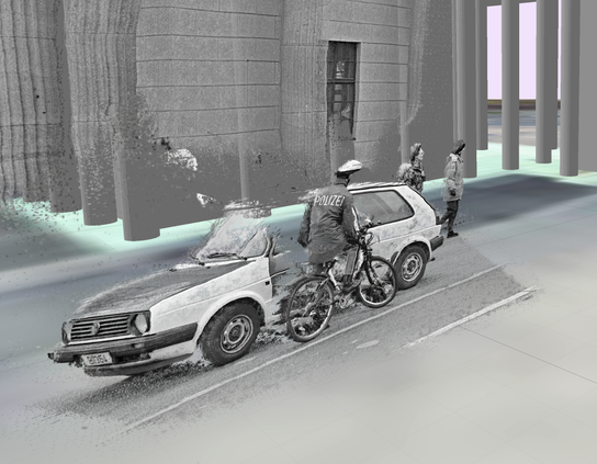
Another attemt at crossing image segmentation with spatial reconstruction.
Looking for strategies to reduce noise / floating points. Any ideas?


