Die Überwachung in Zügen nimmt auch stetig zu.

| Languages | de, en |
I didn't try navigation, as I rarely use that in any maps app. Also didn't try track recording (have specialized apps and devices for that), but I also don't expect surprises there.
Overall, I'll probably keep using my highly customized hiking OsmAnd setup, but I will probably also recommend CoMaps to less sophisticated or less tech-y people.
Me – a long time, happy, and paying OsmAnd user – tried @CoMaps for the first time:
It's pretty good! It obviously has fewer features than OsmAnd but because of that it's also much more usable, especially for beginners. Rendering speed is 💯 allowing to dynamically drag around and zoom the map. Map download management is straight-forward, allowing to easily download maps on demand or upfront when needed. Public transport view, walking/hiking paths, and altitude lines also work nicely.


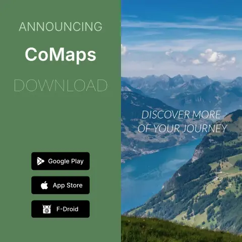
Exciting News!
We're thrilled to announce the release of CoMaps to Google Play Store, Apple App Store, and F-Droid!
CoMaps Highlights
· Offline Search and Routing
· Saves battery
· Privacy-respecting
· Free and No Ads
What makes CoMaps special?
- Open & Transparent
- Community Empowerment
- Free & Not-for-Profit
Download CoMaps Today:
Google Play Store: https://play.google.com/store/apps/details?id=app.comaps.google
Apple App Store: https://apps.apple.com/app/comaps/id6747180809
F-Droid: https://f-droid.org/packages/app.comaps.fdroid/

@JuliaMinamata @stayforever That was a very entertaining and interesting interview!
Well, except for the cringy part where Christian totally misjudged your age 😅