Q-Arctic ERC Synergy Project

@QArctic
3 Followers
9 Following
18 Posts
Q-ARCTIC (http.//q-arctic.net) is a scientific research project with the mission to quantify and simulate Arctic carbon budgets by accounting for the impact of non-linear disturbances at the smallest scales.
We are three teams: Max Planck Institute for Meteorology (MPI-M Hamburg, Germany), Max Planck Institute for Biogeochemistry (MPI-BGC, Jena, Germany) and bgeos (Korneuburg, Austria) to bridge the gap between local processes and global climate models.

EGU26 Session: “Permafrost-climate-feedbacks: past, present and future”

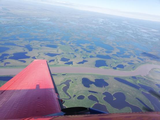
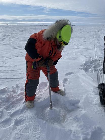
🌍 10% of Earth’s land is permafrost—a frozen giant shaping carbon, water, and energy cycles. As it thaws, it accelerates climate change with global feedbacks.

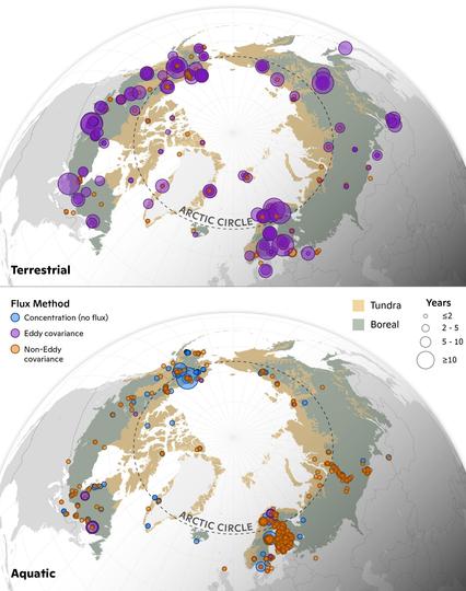
🔬 This session dives into:
✔ Quantifying feedback strength and process-level insights
✔ Future projections for a warming Arctic

🔗 Join the discussion: EGU26 Session #Permafrost #ClimateScience #Arctic #ClimateAction

EGU 2026 in Vienna: Session on “Disturbance processes in Arctic permafrost regions across scales”

Organized by the Q-Arctic team and international colleagues, this session explores rapid Arctic warming and its cascading effects: permafrost thaw, vegetation shifts, hydrological changes, and wildfires.

Topics include thermokarst, coastal erosion, human impacts, mass movements, and biogeochemical fluxes.

🔗 Check the session & abstracts: EGU26 Session 56296

Sentinel-1 satellites provide unprecedented Arctic ground deformation data, but creating consistent records is challenging. We analyzed six permafrost regions, testing terrain and vegetation factors. The analysis showed interesting results on the patterns of seasonal and long-term deformation. Thus, remote sensing remains essential for tracking permafrost degradation in the Arctic due to scarce in situ data and low predictability.
Led by Annett Bartsch & Barbara Widhalm (b.geos GmbH, Austria).
Arctic permafrost thaw, especially abrupt ground-ice collapse, can create lakes that reshape landscapes and affect hydrology, energy exchange, and carbon cycles. Representing these lakes in models is difficult, however. Our study presents a novel stochastic modelling approach that could potentially improve estimates of future Arctic carbon, energy and water fluxes. 📖 https://tc.copernicus.org/articles/20/1967/2026/
Photo credit: Ingmar Nitze
Arctic lakes, bays, and lagoons are vital to northern ecosystems and communities, affecting climate and livelihoods. Many shallow Arctic waterbodies freeze fully, while deeper ones keep liquid water beneath floating ice. Radar satellites often misclassify saline or brackish waterbodies as fully frozen. Combining field with radar data, researchers developed a better method for this, improving understanding of permafrost, greenhouse gases and winter water availability.
https://agupubs.onlinelibrary.wiley.com/doi/10.1029/2025WR040504
As permafrost warms, it becomes unstable and allows ancient methane to escape through new conduits. In July 2025, we collaborated with NRC and NRCan in the Mackenzie River Delta to study these seeps. Using UAVs, we measured one seep emitting emissions of 2.2 km² of the surrounding landscape. Our findings show that these small-scale features are essential for accurate regional carbon budgets and understanding the Arctic methane balance.
preprint: https://egusphere.copernicus.org/preprints/2026/egusphere-2026-51/
Evaluation of UAV-based methods for quantifying methane point source emissions

Abstract. Uncrewed aerial vehicles (UAVs) are increasingly becoming essential monitoring tools across a rapidly growing set of applications, due to their operational versatility,  relatively low operating cost, and provision of data at a range of spatial scales. However, UAV-based measurement methodologies and associated instruments for atmospheric research are still in their early stages and require extensive efforts to exploit their full potential. In Arctic regions, geological CH4 seeps can  release CH4 at rates significantly higher than typical biogenic sources and those associated with permafrost degradation processes; hence, accurate quantification of their emission rates is crucial for the overall CH4 budget of the Arctic. The application of conventional greenhouse gas monitoring platforms – flux chambers and eddy-covariance towers – may become impractical as eddy-covariance towers are stationary point measuring devices that require long observation times with reliable footprint modeling to constrain emissions while flux chambers have a small footprints and therefore require multiple measurements and have a high potential of introducing disturbances. UAVs can overcome these limitations as they can capture the spatial extent of the gas plume released from a point source with minimal disturbance to the source. In July 2025, we deployed two UAV platforms with different sensing instruments to sample a known geological CH4 seep located at the Mackenzie River Delta, Canada. We flew vertical "curtain" patterns with open-path and closed-path CH4 instruments to sample gas concentrations in flux planes at different downwind distances from the gas seep. We first evaluated the performance of the UAV-mounted instrumentation, comparing the open- and closed-path greenhouse gas analyzers. We then compared two widely used quantification techniques – mass-balance and Gaussian plume inversion – finding that mass-balance approaches yielded the most robust quantification with smaller uncertainties. We estimate that the seep emission rate falls in the range of 7.1 to 16.2 kg CH4 h-1, with an average estimated rate of 11.4 ± 6.8 kg CH4 h-1. The emissions from this single point are equivalent to the biogenic flux from approximately 2.2 km2 of the surrounding permafrost landscape, underscoring the need to assess the potentially significant contribution of geological seeps to regional and pan-Arctic carbon budgets.

Arctic landscapes include wetlands, tundra, shrubland, freshwater ecosystems, some underlain by permafrost. The ABCFlux v2 synthesis compiles in-situ carbon flux from Arctic landscapes and various methods. It reveals significant variation in carbon fluxes, aiding improved Arctic carbon budget estimates. Co-led by Judith Vogt (MPI, Germany) and Woodwell Climate Center (USA).

https://doi.org/10.5194/essd-2025-585
https://doi.org/10.3334/ORNLDAAC/2448

Photo: Christina Shintani, Woodwell Climate Research Center

Congratulations to Kseniia Ivanova for successfully defending her PhD thesis at the Friedrich Schiller University Jena.
We are pleased to share that Kseniia will continue her work on the QArctic project. We look forward to her continued presence in the group.
Please join us in congratulating Kseniia on her defense and her new position! ✨
#PhDDefense #JenaUniversity #QArctic #Postdoc #NewChapter #WomenInScience #ClimateResearch #AcademicSuccess
At @MPI_Meteo (Hamburg), we’re modeling Arctic complexity for Q-ARCTIC, led by Victor Brovkin. The Arctic isn’t uniform—it’s wetlands, tundra, ponds, snow, and shrubs, but most models average it all.
Using ICON with JSBACH, we split grid cells into tiles, each with unique physics for water, heat, and carbon. This reveals how moisture and energy move between zones, driving Arctic feedbacks and global impacts.
#QARCTIC #ClimateChange #ArcticScience #EarthSystemModeling #ICON #JSBACH
At b.geos GmbH, Annett Bartsch’s team leads the remote-sensing for Q-ARCTIC. They monitor how warming permafrost and shifting hydrology reshape the landscape. Using satellite radar, optical data, and drones, the group tracks surface subsidence, lake drainage, and vegetation recovery. By bridging local field data with multi-year satellite series, they provide a pan-Arctic view of change, which is essential for improving climate models on thaw and carbon exchange.