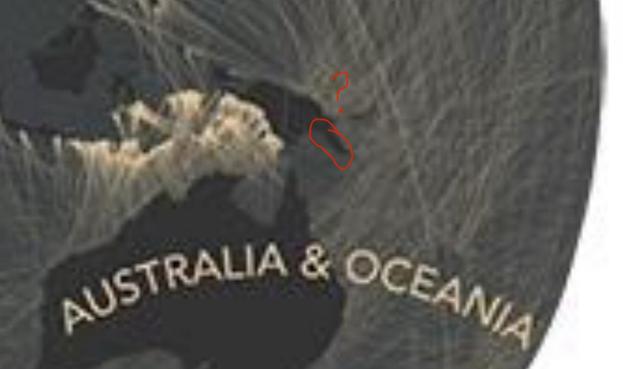
Which country is across the ocean?
@infobeautiful
Incomplete, isn’t it?
@iamlayer8 @infobeautiful It *would* be nice to see the information centrex on East Asia and Australasia.
@infobeautiful @User47 Fascinating to see information like this individual format that's easy to understand. But I see that even though Australia is referenced on the map, it doesn't actually appear on it. Or am I just missing it?
@mlanger @infobeautiful yeah no aussies. Weird
@User47 @mlanger @infobeautiful it's weird Australia is left off, but as someone from New Zealand, I'm not surprised we were left off 😂
@Frenchtoastpeasant @User47 @mlanger @infobeautiful I think it’s just a pair of projections that were chosen that don’t cover two halves of the earth. There should either be a third one or else some different projection.
@Frenchtoastpeasant @User47 @mlanger @infobeautiful It is, of course, opinionated on which country you are crossing the ocean FROM - eg is Columbia across the ocean from Panama, or is Panama across the ocean from Columbia? The answer is of course “both”; the chart chooses one semi-arbitrarily to put in the relevant bit of ocean.
@Frenchtoastpeasant @User47 @mlanger @infobeautiful Here are some more informative answers to “what is across the ocean from here”: https://andywoodruff.com/blog/beyond-the-sea/
Beyond the sea | Andy Woodruff

@Frenchtoastpeasant @User47 @mlanger @infobeautiful I love the idea that there are places half a world away from me here in Australia where you could stand, possibly even on land, and point in a certain direction and correctly say “Australia is across the ocean that way”, and then turn about 90° and also correctly say “Australia is across the ocean that way”.

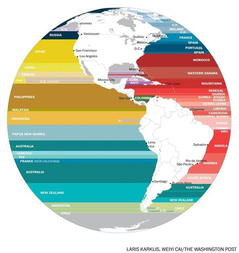
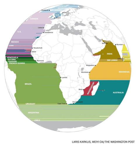
@Frenchtoastpeasant @User47 @mlanger @infobeautiful Hello @awoodruff - I very much enjoyed your “beyond the sea” maps, both static and interactive, from about 10 years ago (!).

I wonder if you can help me understand what’s going on with the coast of PNG near Port Moresby not seeming to have a “view” of Australia in the static map?

@whybird @Frenchtoastpeasant @User47 @mlanger @infobeautiful Thanks! I’ll have to look again, but I believe Papua New Guinea is being lumped in with Oceania (vs Asia for Indonesia), and the map only shows “views” from outside each continent. So grouping Oceania with Australia means views from islands to Australia are hidden. I think I wanted the emphasis to be on distant views to faraway continents, but it does make things odd here!
@awoodruff @Frenchtoastpeasant @User47 @mlanger @infobeautiful Ah, of course it’s the human-made line half way across the island making a logical mess of things as always. Thank you; I understand now. Again: superb work. (I love your flow contour stuff too!)