Here’s a preview from a new series I’ve been working on. This is a detail from #Petrofuture Scotland, showing Edinburgh and the Firth of Forth with 66m sea level rise, on top of a vintage Esso road map.
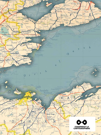
Here’s a preview from a new series I’ve been working on. This is a detail from #Petrofuture Scotland, showing Edinburgh and the Firth of Forth with 66m sea level rise, on top of a vintage Esso road map.
@ludd Thanks! For source material, I digitize old oil company maps, and overlay a digital terrain model.
In terms of process, I georeference the digitized maps using GIS software, model 66m sea level rise with the DTM, and then export it all to photoshop.