I saw this on Reddit, and having the data to hand, I thought I'd replicate it:
https://www.reddit.com/r/europe/comments/1s61cou/how_european_cities_stack_up_in_density/#lightbox
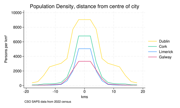
I saw this on Reddit, and having the data to hand, I thought I'd replicate it:
https://www.reddit.com/r/europe/comments/1s61cou/how_european_cities_stack_up_in_density/#lightbox
@bthalpin ok, fair enough.
Do you know where the centre of dublin, used in the graph, is located?
I picked it myself, Ormond Quay, roughly centre of the central district.
https://www.openstreetmap.org/search?query=53.346211%2C+-6.266037&button=#map=15/53.34621/-6.26604
