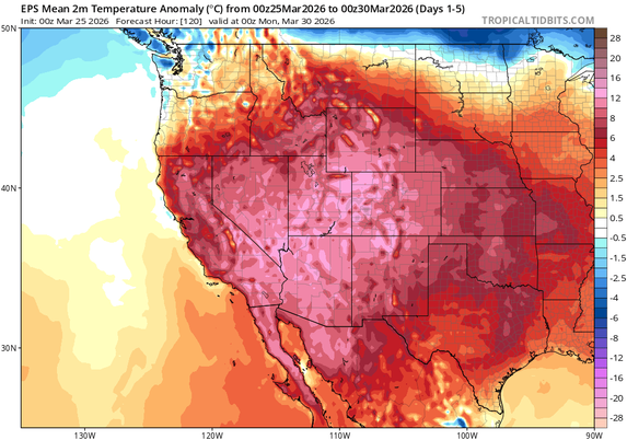
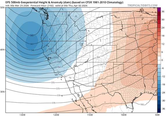
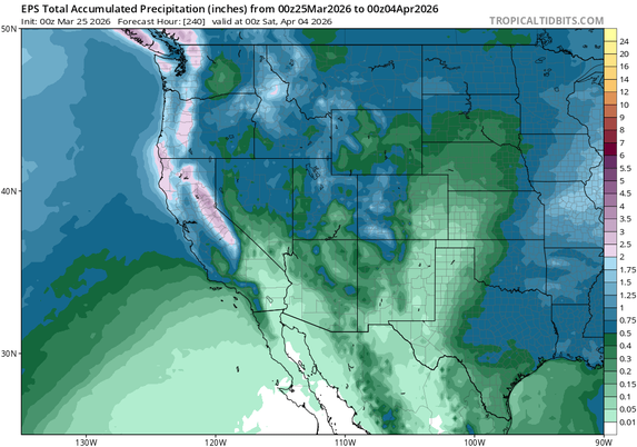
The extraordinary March 2026 heatwave continues across the western and central U.S. Yet more daily to monthly record high temperatures will occur over the next few days, and snowpack will reach new March record lows. But some relief is on the horizon...
By Mar 31/Apr 1, the ridiculous ridge will finally move eastward, opening door for a pair of decent April storm systems to affect most of the West (including CA). The first storm will be warm, with rain even in high mountains, but second will be colder w/accumulating mtn snow.
While there's still uncertainty in how much rain (& high mtn snow) will actually fall, current likeliest outcome is some respectable April accumulations. I'd expect 0.5-1 inch between the 2 systems at lower elevations of NorCal, w/ 1-3 inches of liquid equiv in mtns. SoCal = TBD.
In relative terms, this likely be quite respectable...for April. In absolute terms, this is not a notably cold or wet pattern and will not come close to erasing record-breaking mtn snow deficits that are now in place (it essentially will stem the decline for a week or so).
The transient trough will then move eastward & dissipate, allowing CA to warm & dry once again. It does not look like we're headed for sustainedly cool or wet April; warmer than avg temps will likely return. But it does appear there will be real, if brief, reprieve in early Apr!
@weatherwest I sure hope some rain makes it into Arizona 🤞