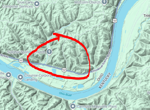
2,080 acre hyperscale data center zoning map application submitted in Maysville-Mason County #Kentucky near the #OhioRiver in rural #Appalachia for “Cloud computing technologies.”
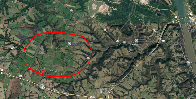
The site is in the Ohio River Watershed, along the boundary between the Lee Creek and Lawrence Creek
sub-watersheds.
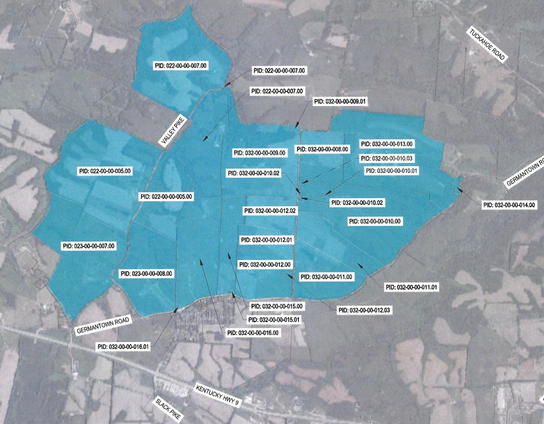
The project, west of downtown Maysville, is near Slack Pike Road, Germantown Road and Valley Pike near 'D's Thirsty Beaver' which is located at 3538 Germantown Rd, Maysville, KY 41056.
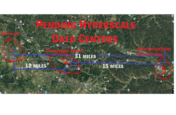
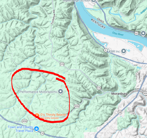
This is the third hype-scale data center within 31 miles to be built. # 2, in the last image, at the former Stuart Coal power plant in Adams County, Manchester, Ohio, has already received federal approval. Another one is planned for the shuttered Killen Station in Rome, Ohio, just east of Manchester, Ohio, all on the Ohio River, in Adams County, also.
The Maysville-Mason County Joint Planning Commission will host two days of public hearings on Wednesday, March 25, and Thursday, March 26 at 5:30 p.m. at the Maysville Community and Technical College Fields Auditorium.
Data Center portal, City of Maysville-Mason County Joint Planning Commission:
https://www.cityofmaysvilleky.gov/departments/codes_department/data_center.php #Ohio #AppalachianOhio
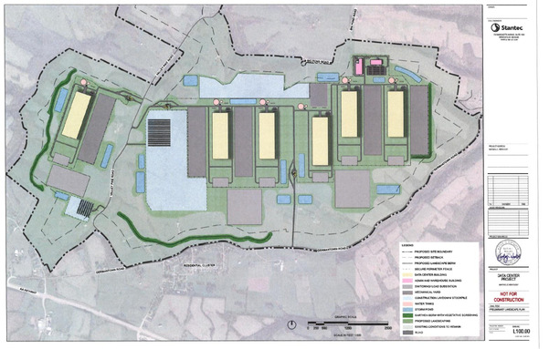
Data Center zoning application: https://cms5.revize.com/revize/maysville/Document%20Center/Forms/New%20node/Planning%20&%20Zoning/Rezoning%20Application%20-%20Proposed%20Data%20Center%20in%20Mason%20County.pdf?t=202603121435580&t=202603121435580