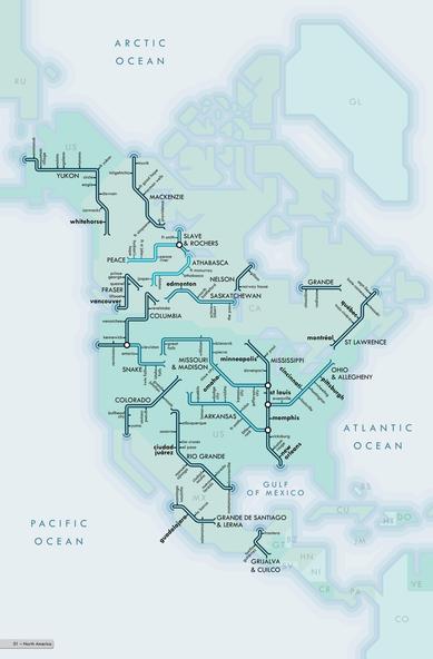
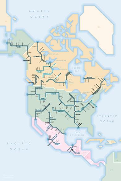
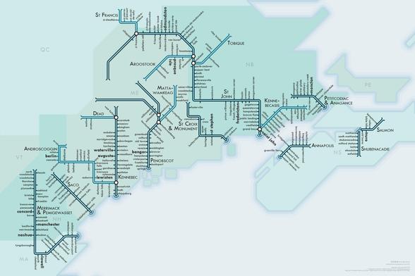
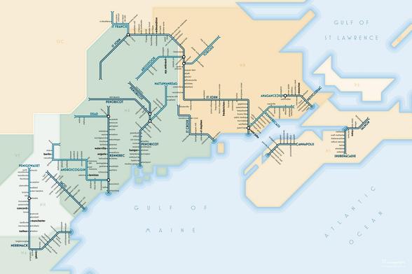
Back to my long-running project of upgrading the style on my old river maps from the ca. 2010 style (for a book I never printed) to the more colorful poster style I've been using since about 2020.
somethingaboutmaps.wordpress.com/river-maps/

The work on these sort of never ends. I've made them, upgraded them, restyled them, reformatted them, etc. as time goes on. And I'll probably keep doing so.

And one more done today: an upgrade for the Gulf of Maine piece.

Client work has been quiet for several days, and it's been great to have time to relax and have fun with my own projects. This little break is much needed.

Next up I'm probably going to make a new piece that replaces a group of older ones. Since I'd originally designed these years ago to go in an atlas, I split the Ohio river system up into 4 maps. They can't easily be joined & restyled, so I'll make a new one to encompass the system in a poster size.
@pinakographos this is cool - you now have a bit of room to squeeze in the Presumpscot, between the Saco and the Kennebec, so you could get Portland on the map!!