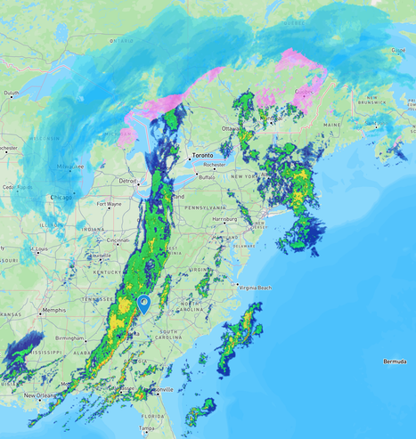
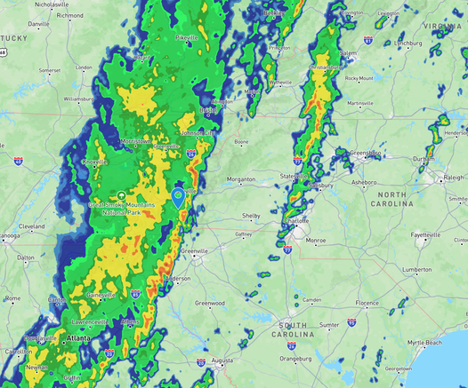
Heads up, #Asheville and frankly the whole east coast. The huge, dripping line of storms is probably in the western mountains and almost here.

It now extends from the Gulf east of New Orleans, way up into Canada, bringing a variety of challenges for everyone this #Monday morning.

This may usher in really bad weather, so please remain weather-aware. We were just issued a Severe Thunderstorm Alert here in the city. Get ready, everybody.

#NCwx

At 7:30, my region slightly SW of #Asheville has seen the first line of red storm pass by, so for a while we're in a steady rain area, before entering another yellow stretch.

The leading edge is moving east, keep an eye out, friends.

#NCwx

@czarbucks Seems like it is moving through quickly. Hopefully that will help and give it less of a chance for destabilization.

@deewani

Thanks, I hope so, although that fast moving doesn't bode well for our state's eastern, flatter sections. Hoping no one has trouble from this monster.

@czarbucks Me too. The size of this thing! https://zoom.earth
Zoom Earth | Weather Map & Hurricane Tracker

Interactive weather & radar map. Track hurricanes, cyclones, storms. View LIVE satellite images, rain maps, forecast maps of wind, temperature for your location.

Zoom Earth