We return to the southern hemisphere this week in #geoweirdness
We head to a country of vast deserts and long coasts - join us as we consider the geographic oddities of Namibia 🇳🇦
https://en.wikipedia.org/wiki/Namibia
1/
We return to the southern hemisphere this week in #geoweirdness
We head to a country of vast deserts and long coasts - join us as we consider the geographic oddities of Namibia 🇳🇦
https://en.wikipedia.org/wiki/Namibia
1/
2/ As with many African countries colonized by European powers (in this case Germany 🇩🇪), 🇳🇦 Namibia’s contemporary borders are characterized by artificially straight lines that don't necessarily relate to the local geology.
This site walks through the history of each border line and the various treaties between the respective powers:
https://atlasofnamibia.online/chapter-1/international-boundaries
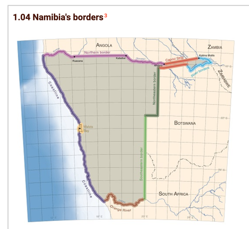
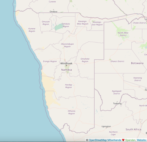
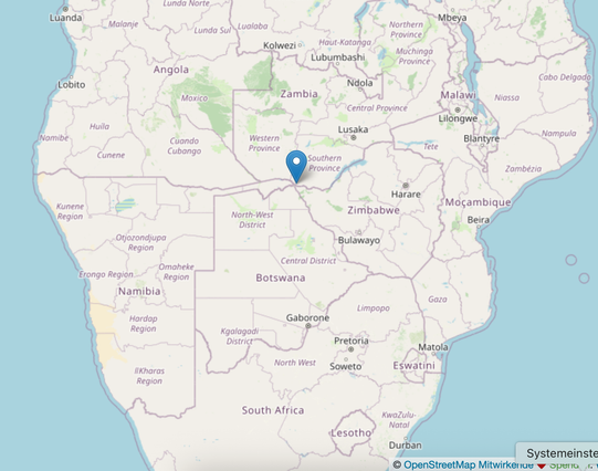
3/ The Caprivi Strip is a distinctive 450 km panhandle that extends eastward from the main body of Namibia 🇳🇦.
This unusual geographic shape was established by the Heligoland–Zanzibar Treaty of 1890 between the Germany 🇩🇪 and the UK 🇬🇧.
Germany negotiated the strip to gain access to the Zambezi River and, thus an inland trade route to the Indian Ocean.
This strategic objective proved unviable due to the presence of the formidable Victoria Falls.
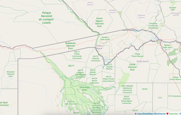
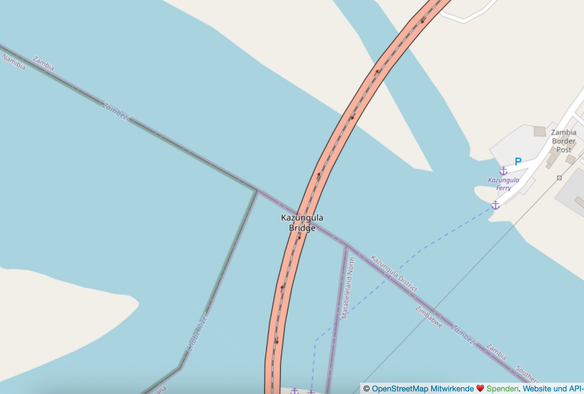
4/ At the Caprivi Strip's unique eastern corner, Namibia 🇳🇦 is one of four countries - along with Botswana 🇧🇼, Zambia 🇿🇲, and Zimbabwe 🇿🇼 - whose borders come achingly close to forming a perfect quadripoint.
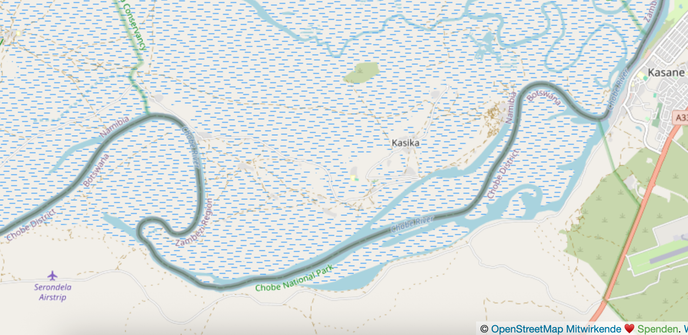
5/ The border definitions in this water-rich region led to an intense dispute with Botswana 🇧🇼 over islands in the Chobe River: Sedudu (called Kasikili by Namibia 🇳🇦) and Situngu.
The 1890 treaty was ambiguous, defining the boundary by the main channel. The ICJ (International Court of Justice) ultimately ruled in 1999 that the main channel put both islands in Botswana.
6/ Namibia 🇳🇦 was one of the last countries in Africa to gain independence.
Following Germany's defeat in WWI, South West Africa, as the region was then known, was administered by South Africa 🇿🇦 under a League of Nations mandate, which became a sort of de-facto annexation.
in 1969 the UN 🇺🇳, successor to the League of Nations, declared South Africa's occupation of Namibia illegal.

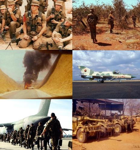
7/ As pressure for independence grew in the 70s and 80s Namibia 🇳🇦 and neighboring Zambia 🇿🇲 and Angola 🇦🇴 became the site of proxy war between cold war blocks, with Cuban 🇨🇺 and Angolan troops (supported by the Soviet Union) fighting against South Africans
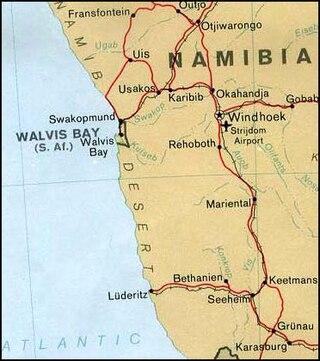
8/ Finally in 1990 South Africa 🇿🇦 withdrew and Namibia 🇳🇦 achieved independece.
However the deep-water port of Walvis Bay remained under the control of South Africa until 1994.
This political retention created a significant South African enclave on the Namibian coast, controlling the newly sovereign nation's primary gateway to the sea.
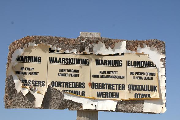
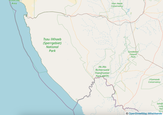
9/ Heading south along the coast, the Sperrgebiet ("Prohibited Area" in German) is a massive coastal strip - about 26,000 sq km - that was historically sealed off.
Why? Because the area is rich in alluvial diamonds that could simply be picked up off the ground.
It is one of the largest closed resource-control areas on the planet.
https://en.wikipedia.org/wiki/Tsau_%C7%81Khaeb_Sperrgebiet_National_Park
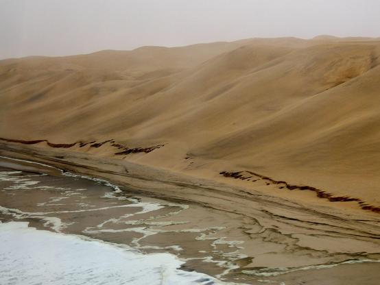
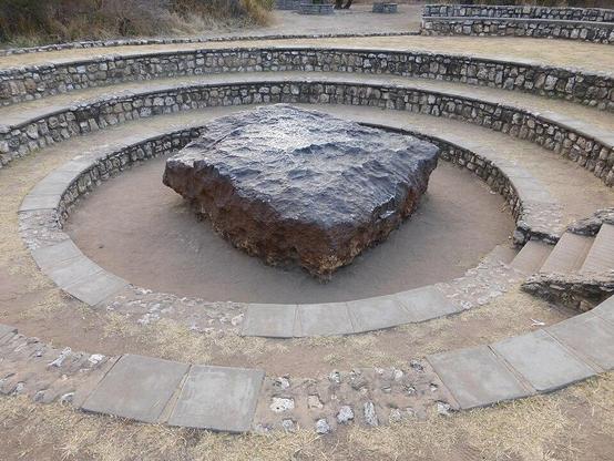
10/ In #geoweirdness we focus mainly on political geography, but we must mention that Namibia 🇳🇦 has amazing geological features.
The Namib desert stretches for more than 2,000km while Dragon’s Breath Cave contains the world's largest underground lake
The country is a major producer of rare earths and uranium.
It is also the site of the Hoba Meteorite, the world's largest known single-piece meteorite, with a mass of 60 tons.
11/ That wraps up our look at the geographic strangeness of Namibia 🇳🇦
What did we overlook?
We have more threads about specific countries, border disputes, geocoding, etc linked on our blog: https://blog.opencagedata.com/geothreads
If African #geoweirdness is your thing you may enjoy our threads about
🇿🇦 South Africa https://en.osm.town/@opencage/110247462187801704
and
The Congos 🇨🇩🇨🇬
https://en.osm.town/@opencage/116034618995930758