Today, I'll start walking along the coast of Hong Kong Island, and see how far I'll get! :D

Starting in Western District, which is bustling and densely-populated.

This is 青洲 – Green Island!
The trees are working really hard at reclaiming the city here!
More of these trees that we saw in the last days! It's the Chinese banyan aka "curtain fig". And it seems that it's sometimes actively used to stabilize slopes!
"Don't toot!" 😬

Made it around Mount Davis, and reached Waterfall Bay!

This part of the coast consists of a couple of connected public parks, which feel nice to walk in.

Oh hello! It seems that instead of discarding your deity figure, you can bring them here, and a member of the local community will take care if them!

Other places I've been to: "Oh yeah, the city has a *downtown* area, and there you can find a couple of higher buildings."

Hong Kong: *casually sprinkles 40-storey skyscrapes all over the place*

Made it to Deepwater Bay in the South of Hong Kong Island, the first beach I've seen here. Time for a break!
Tin Hau Temple, which is dedicated to a Chinese sea goddess.

The map I'm following for the "around-the-island trail" denotes a couple of "safe deviations". So far, they seemed to lead around construction sites, for example, and once, to avoid a locked gate (which I realized too late, and which caused me a ~2 km detour. 🤦

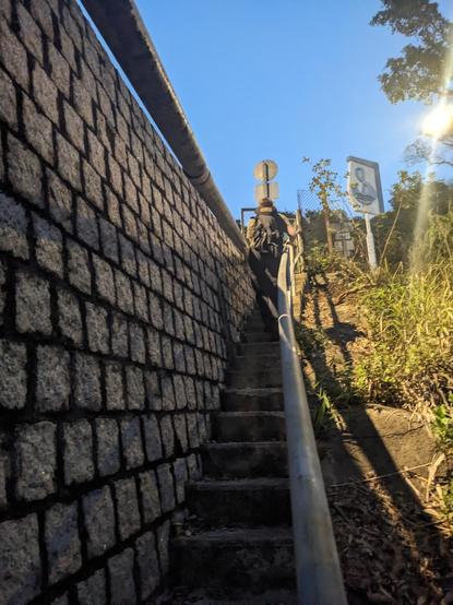
But for this one, I'm glad that I didn't follow the deviation, and instead followed the shore!

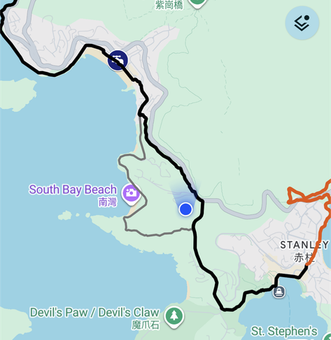
It seemed like a bit of a gamble: Following the shore could be a really pretty and interesting path (instead of walking along a street).

On the other hand, the path could be impassable, or dangerous.

I also (again) realized too late that the official route would go another way, so it would've cost me time to turn around. I decided to see how far I'd get!

It quickly turned out that it would be an uphill hike. The first few steps were still made from concrete...
...but the stairs quickly turned into a somewhat crumbly (but safely walkable) situation.

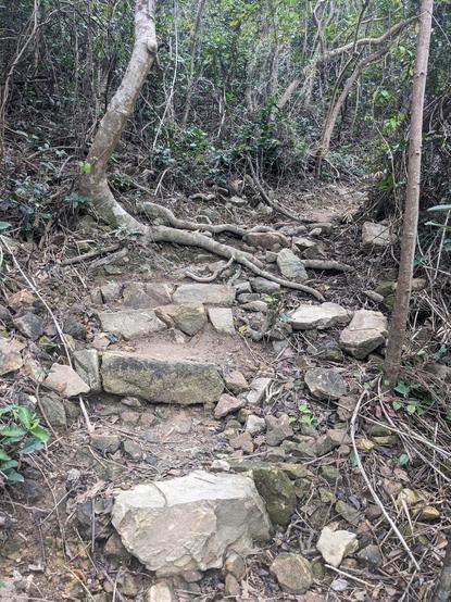
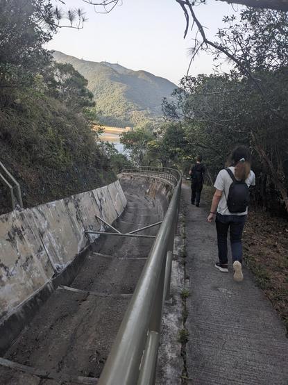
So I followed this path up for maybe 20 minutes. At ~22 °C, I was sweating a lot!

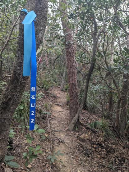
A mid-forest crossroads had this beautiful way of marking the different directions!

At one point, I met two people hiking downhill, which gave me a feeling or relief: I would be able to get through there *somewhere*!

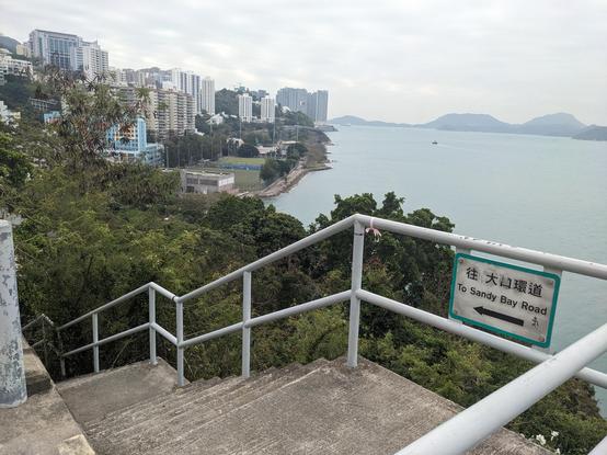
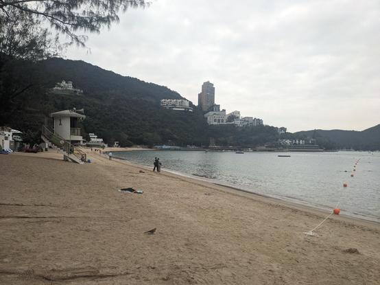
Eventually, the view opened up, and revealed the Stanley Peninsula!

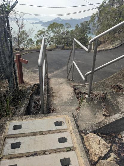
I continued on that path, and reached a concrete street again, that led to a water reservoir on the top of the mountain.

That was a neat little sub-adventure! :D

Made it to Stanley!

And just as I was considering my next steps, *these* folks turn up! :'D @robbi5 @ubahnverleih

We had joked about playing "tag" (and I was carrying an AirTag), but I hadn't *actually* expected to be hunted across the island! xD

We're continuing the hike together, following a water collection canal.
The canal continued curving along, and finally ended in a water reservoir. That was a very pleasant, relatively flat path!
We entered peaceful bay, and found this bike graveyard close to a settlement. One person seemed very surprised that three foreigners would pass through here.
OH @robbi5: "No blinry, we're *not* going up there!"

Next, we're following up a dry river bed.

"If it's mapped as a path in OSM, we can walk it"?

Next, we balanced along this pipe... 😱

Just kidding.

We won't actually need to do that.

I think.

Ummm.
We made it up to a street using some "slope maintennace" stairs! Well, that was a bit stressful! 😬 Now taking a bus to an MTR station.
Stats of my hike today! :D Thanks for following along. We're off to a curry!
@blinry wow, 30 km in one day is quite a lot by foot!
@daniel_bohrer Gotta train for 100! :D
@blinry 100km by train sounds manageable 😃 @daniel_bohrer
@blinry which app do you use?
GitHub - jonasoreland/runnerup: A open source run tracker

A open source run tracker. Contribute to jonasoreland/runnerup development by creating an account on GitHub.

GitHub
@blinry It's been really fun to follow along - thanks for sharing! 😊
@blinry hope that is tagged correctly in OSM, steel pipe with handrail
@noiob @blinry doesn't seem like it, but at least it's named "The Pipe" https://www.openstreetmap.org/way/323624505
Way: ‪The Pipe‬ (‪323624505‬)

OpenStreetMap is a map of the world, created by people like you and free to use under an open license.

OpenStreetMap
@blinry if you happen to discover a leak in the pipe, I'm interested which color the gel has, orange, white or blue… :3
@blinry "If it's mapped as a path in OSM, we can walk it" is a trap I've fallen into more times than I'd like to admit.
@RedGlow @blinry I have to admit, sometimes I am the one mapping those paths in the first place… 🙈
@blinry adventure! 💖