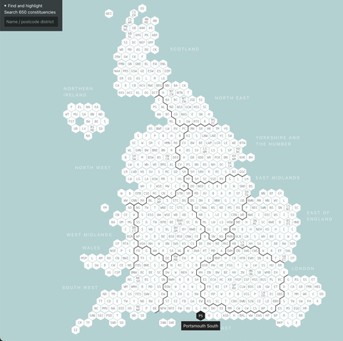
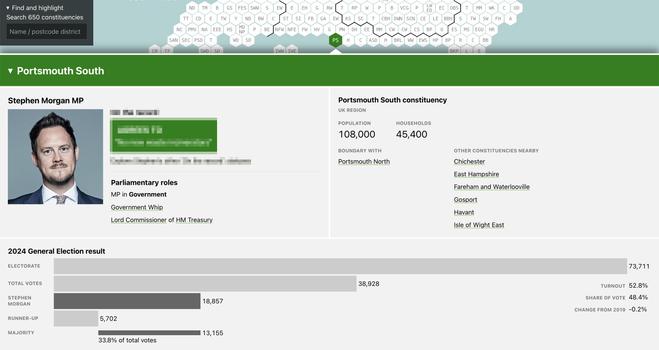
Coming to you from just north of the sea, at the bottom of Portsmouth South, a preview of a thing I have made.
It’s a resizeable interactive hexmap of UK constituencies:
- It builds upon the hexmap layout developed by Open Innovations: https://open-innovations.org/blog/2023-08-03-hexes-for-the-next-general-election
- But instead of SVG, it’s rendered from JSON using CSS grid, and each cell is a `<button>` that can open an info panel.
It’s a work in progress for something I’m collaborating on. Hopefully, more on the interface later this month.