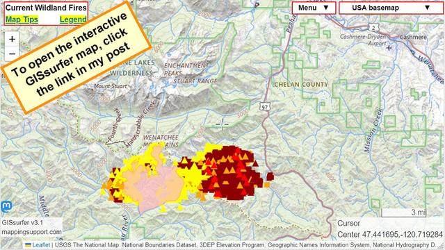
#LaborMountainFire SW of Cashmere WA. This is on the east slopes of the Cascade Mountains. US highway 97 is closed.
Dark red symbols are heat detections by satellite within prior 6 hours.
The winds from the weekend have died down so hopefully the fire spread will slow down. At the time of my post the most recent perimeter data is several days old.
#WAfire #WAwx #Wildfire