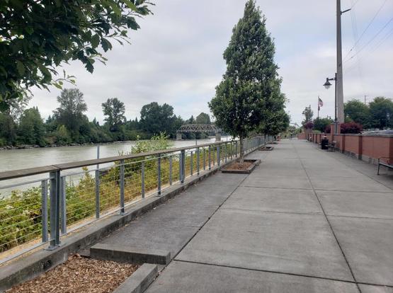
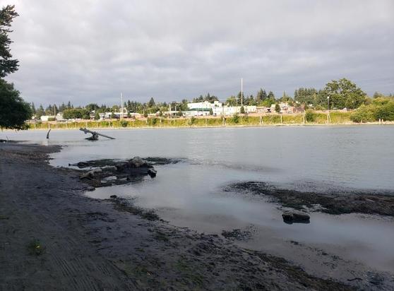
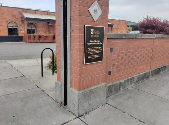
With the tsunami advisory a few days back, I got interested in the differences between two nearby rivers: the Skagit and the Snohomish.

Both rivers end in Puget Sound, in the Whidbey basin, but the Skagit had a tsunami risk that went much more inland than the Snohomish. I was curious about that, and in trying to understand the reason, I learned a few things.

#pnw

1/n

First, what I got wrong.

I thought maybe more water was entering from the ocean through Deception pass, which is closer to the Skagit river.

But I was mistaken. Even though water enters Deception Pass *very fast*, most of the ocean water enters through the South, through Posession Sound, which is closer to the Snohomish river.

The video linked shows this using the Puget Sound model (which is a really cool model to check out in real life):

https://youtu.be/OEQP5BwVh7A?t=181

#PugetSound
2/n

The Puget Sound Model: Tides and Currents

YouTube

@guyjantic pointed out it might be a problem of topography, and they were onto something. These topographic pictures show how the area around the mouth of the Skagit is much lower in elevation than around the mouth of the Snohomish. In fact, I5 lays at only ~20 ft above sea level between Mount Vernon and Burlington! Much of the surrounding area is equally low (or lower).

#pnw

3/n

While I'm not sure if the size of the rivers is relevant for what happens during a tsunami, I think it's worth noting the differences in size. I knew the Skagit River was larger, but I had not realized how much. According to the video I posted, the Skagit delivers half of all the fresh water in the Puget Sound! 😮

Wikipedia tells me the Skagit discharges an average of 468 m3/s of water, whereas the Snohomish only does 273 m3/s.

Pictures to follow in a bit, to see how this looks irl!

#pnw
4/n

.. and here are the pictures of the rivers, first the Snohomish, as seen from the Langus Riverfront trail, just behind Everett. Then, the Skagit, as seen from the Skagit Riverwalk in Mount Vernon.

5/n

#pnw
#rivers

Continuing from last week, more river talk! This time thinking about flooding in general, not only in the context of a tsunami.

This thread started because the tsunami alert for the Skagit River showed a risk extending further inland than the risk for the Snohomish River. But the Skagit river itself floods periodically, and what I find interesting is the response from Mount Vernon to address the flood risk. This response may be worth considering in the context of #ClimateAdaptation. #pnw

6/n

Mount Vernon's downtown is located by the Skagit River. It has a path overlooking the water, which changes with the seasons depending on the amount of glacier sediment. It's a pleasant place to hang out.

Here are two pictures of the Skagit Riverwalk. First, as seen from the Riverwalk itself, the other as seen from the boat launch accross the river. Notice the brick walls, and their elevation.
7/n
#pnw #FloodRisks

The brick wall is not only decorative, is a flood protection wall that gets to be assembled when there is risk of the Skagit breaching its banks and flooding Mount Vernon's downtown, which has happened. If you look again at the picture in the post above, the water of the Skagit can reach the walkway and flood the downtown. That's a lot of water 😰
In the second picture below, a close up of the wall where the flood protection system is installed in times of emergency.
8/n

#pnw #FloodRisks

So, have the walls worked? Yes! They were put to test in 2021, when the Skagit River rose to 35 feet.

This first video shows the flood wall being assembled, and functioning. The reporter is standing on the other side of the wall, and the wall is holding back the water. I do believe these technologies will prove useful for #ClimateAdaptation to increased #FloodRisks

#pnw #flood #FloodWall

https://youtu.be/ICP936IjxxA

9/n

Mount Vernon flood wall keeps significant amount of water from entering downtown

YouTube

This second video has another reporter standing behind the flood wall, with drone views going above the wall showing the size of the 2021 flood.

If you go back to my previous post (linked below), and see the picture taken from the boat launch, you can picture the incredible amount of water that this river is carrying.

CW, if you are bothered by talk of politics, you can keep the video muted.

https://www.king5.com/article/news/local/murray-senator-flooding-skagit-county/281-4b0de927-9298-495e-8c11-e4180ba9f08b

https://social.coop/@marsiposa/115000861650596723

#flood #FloodWall #pnw #ClimateAdaptation
10/n

Before you continue to YouTube