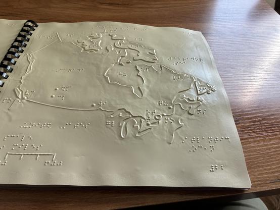
Yay my atlas arrived! This is really cool because I've never actually seen a map of Canada before! All the braille maps here are of the United States because that's where we are so that's where most of the companies focus there manufacturing of maps. It was really cool to actually see a map of Canada and plot out all the different cities where my friends live and the places that I've been! My Atlas has resource maps, elevation maps, climate maps it is really cool! Edited to add a picture
@Pawpower @JPK_elmediat That's really, really cool!!!
What other places are rarer to see in maps?
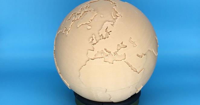
@raindrops_and_roses @JPK_elmediat I would personally like a map of China. I would like a tactile globe because I don't really understand how countries are in relation to one another. If I were rich I'd have a whole library and have one area for maps. Like forget diamonds and cars and all that crap, give me maps.
@Pawpower Yes! Maps and globes!
You probably already know this but I found a tactile globe here:
https://www.aph.org/product/tactile-world-globe/
It's a bit pricey though.
@JPK_elmediat
@raindrops_and_roses @JPK_elmediat Maybe I need to get someone to make me one out of papier-mâché lol