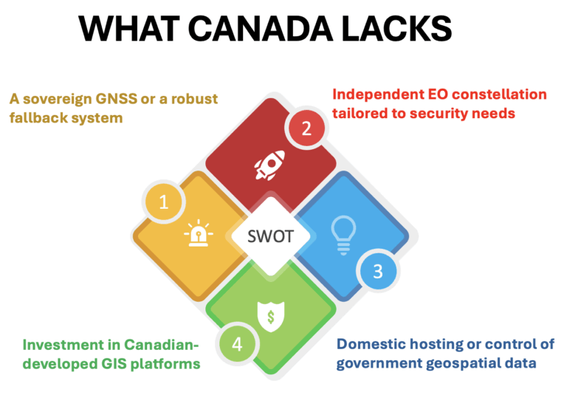
#Canada relies heavily on foreign GNSS systems (primarily U.S. GPS), licenses GIS software from foreign vendors, and outsources significant portions of its spatial data infrastructure. In many cases, critical national geospatial data — used for defense logistics, infrastructure planning, and emergency response — is processed or stored on foreign systems. #geoint https://gogeomatics.ca/geospatial-infrastructure-canadas-defense-strategy-ignores-a-critical-layer/