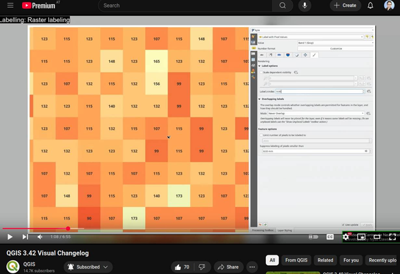
Probably my favorite new feature in #QGIS 3.42 Münster: raster labeling 🤩

It sounds basic but it will be sooo useful for our workflows

https://youtu.be/v6Ejov4u7xk?si=2Sjhn1OAe_0IKdAL

#GISChat

QGIS 3.42 Visual Changelog

YouTube
@underdarkGIS and amazingly helpful for validating data and results
@underdarkGIS it's really awesome hey. Another one I wonder why it doesn't exist already is a way to map ranges or specific raster values via outputting cell centroids.
@underdarkGIS as a workaround, I have been using this plugin to get the pixel values: https://github.com/jorgealmerio/valuetool
Very useful.
GitHub - jorgealmerio/valuetool: QGis plugin to display in a table or plot the values from the visible raster layers at the current mouse position

QGis plugin to display in a table or plot the values from the visible raster layers at the current mouse position - jorgealmerio/valuetool

GitHub