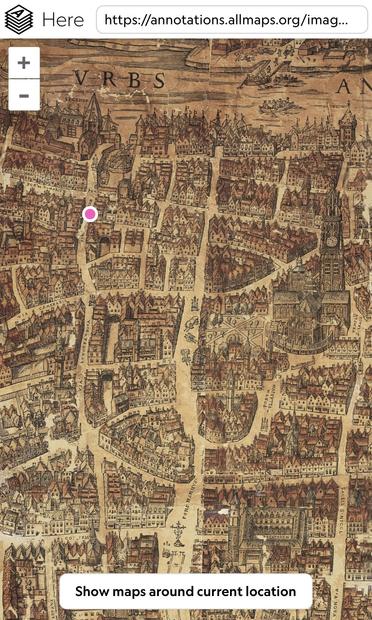
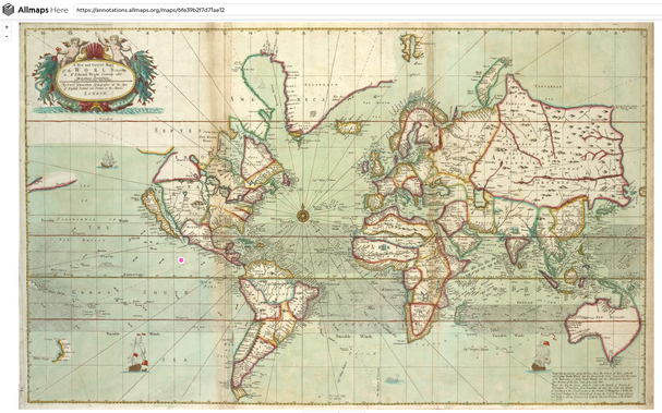
Using GPS in the year 1565
There’s a wonderful web app (“Allmaps Here”) that shows your GPS location on old maps. I love it.
https://www.verbeeld.be/2024/11/17/using-gps-in-the-year-1565/

Using GPS in the year 1565
There’s a wonderful web app (“Allmaps Here”) that shows your GPS location on old maps. I love it.
https://www.verbeeld.be/2024/11/17/using-gps-in-the-year-1565/
@mjambon You can always make the georeferencing of these "correct" maps even more correct, by using this editor: https://editor.allmaps.org/#/
(It's a rabbit hole… I'm spending way too much time there georeferencing and correcting old (local) maps…)
@mjambon I have a similar project at https://onamap.me/
For the lat/lon to pixels algorithm, I use a triangulation of the reference points to interpolate u,v pixel coords based on pixel coords of nearby reference points
https://turfjs.org/docs/api/tin
@mjambon yeah I'm sure for my maps I make mistakes. All I do for error checking is to perform the forwards warping onto satellite imagery in QGIS, then visually check for discrepancies between the two. With this I can catch gross errors. E.g. overlay:
https://www.facebook.com/photo/?fbid=315155968310211
Beyond that, perhaps you could, on a per point basis, leave the point out of the referencing process, then see where it gets mapped to. If it is mapped far away from its reference location, perhaps the reference is wrong.
