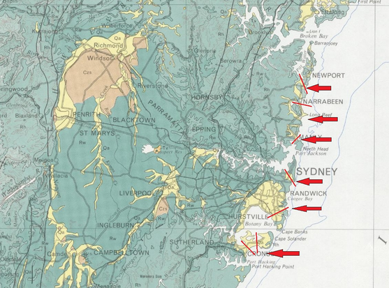
Doomed parts of #sydney. This is a geological map of Sydney and light yellow Qa marks loose sand. Looking at elevations the areas marked with arrows are at risk from sea level rises and associated undermining. The red lines indicate channels that may be cut into the terrain by the sea.